• Home
  • Blog
  • All-terrain wheelchair routes in Shetland
By Promote ShetlandJune 12th 2023

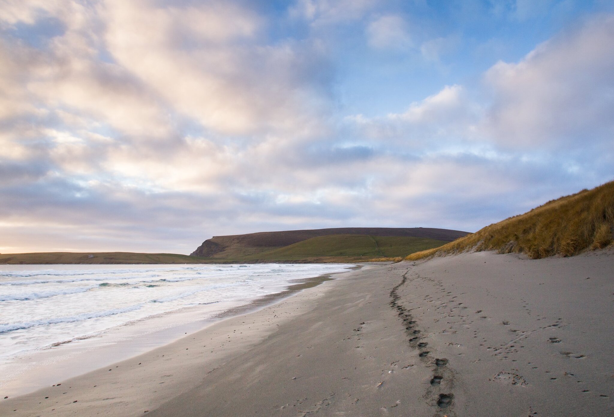
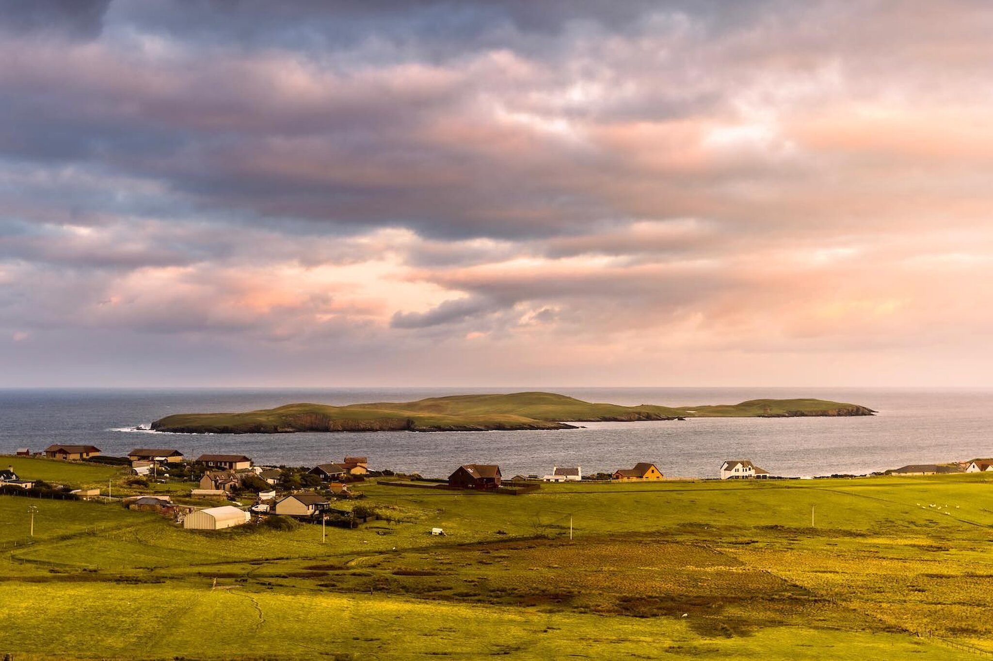
Enjoying the great outdoors is one of the most popular activities in Shetland, whether you’re visiting on holiday or call the islands home.

With such spectacular landscapes, amazing historical sites, and dramatic coastlines it’s easy to see why walking is among the favourite activities for locals and tourists alike.

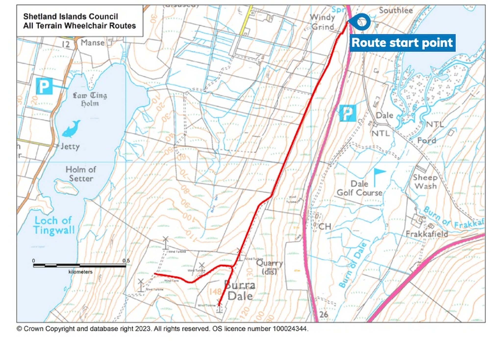
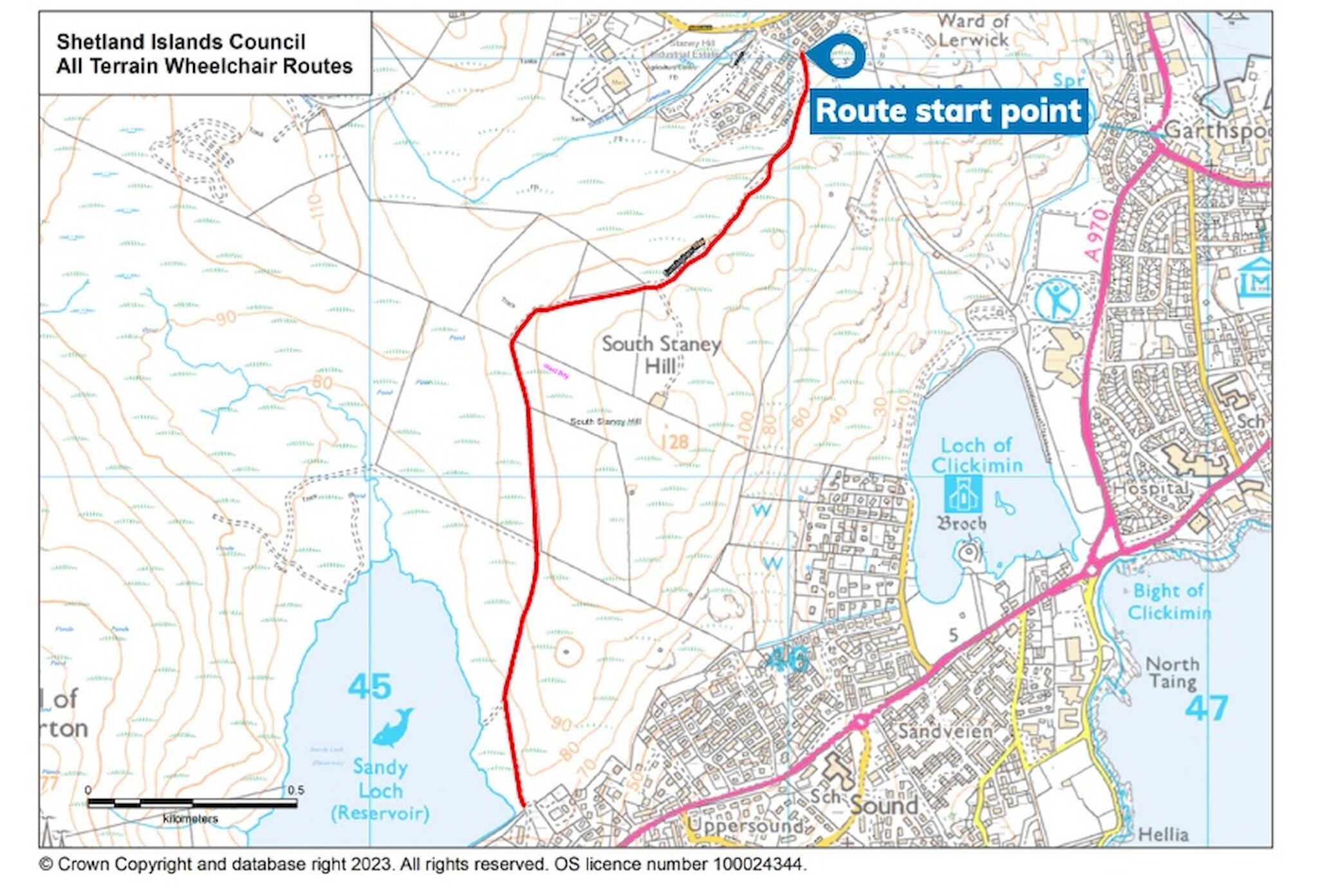
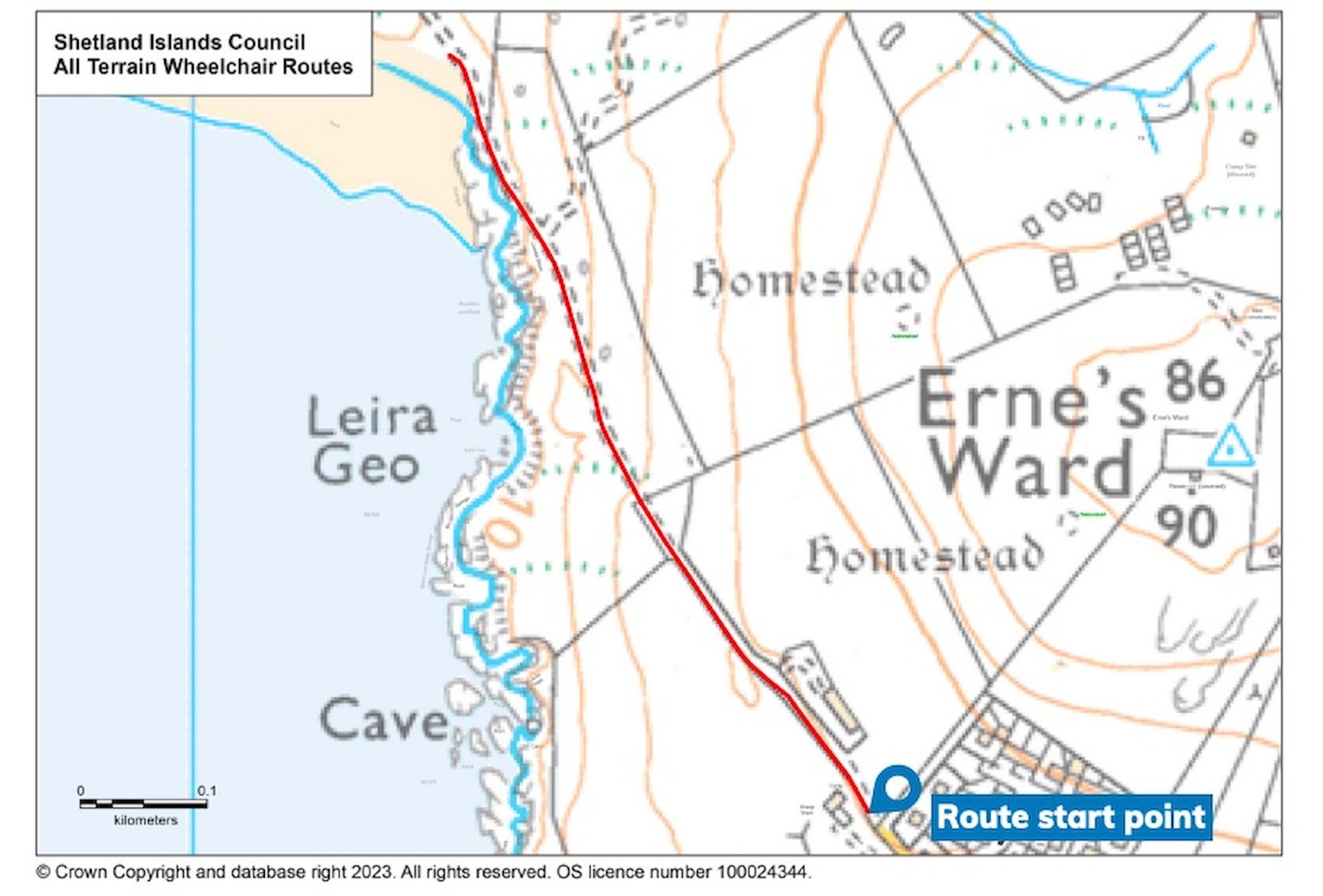
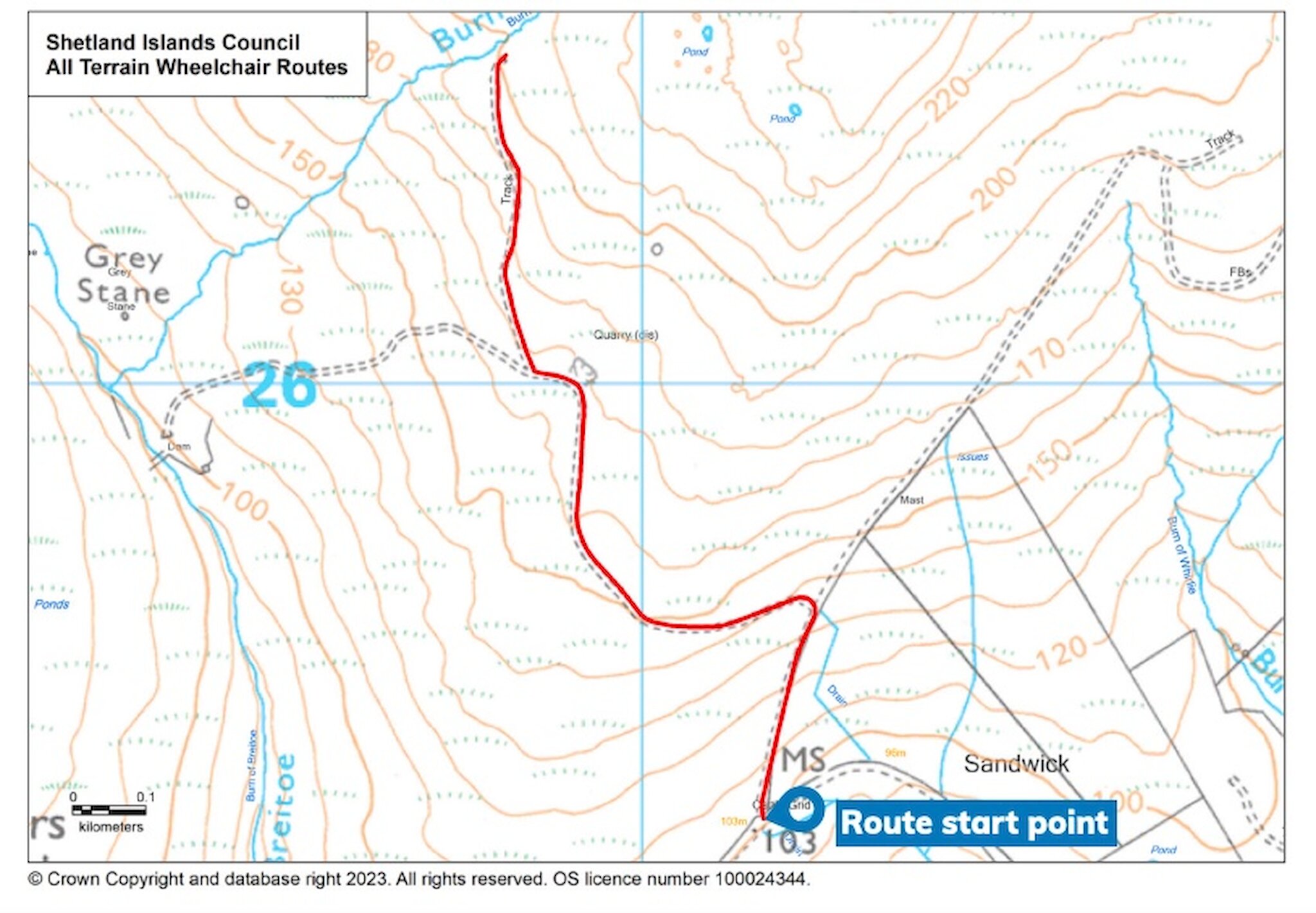
There are also a selection of excellent routes which can be explored using an all-terrain wheelchair, removing barriers to Shetland’s stunning landscapes, and making it possible for more people to access more difficult terrain.

The charity Ability Shetland has four all-terrain wheelchairs available for anyone with physical disabilities and mobility issues, allowing them to access outdoor spaces.

Two attendant wheelchairs where the individual in the chair is pushed by someone else, and two self-propelled chairs are available through Ability Shetland, and can be hired for the day.

There is no charge to borrow the wheelchairs, however donations are welcome. If you are interested call 07895406005 or email abilityshetland@shetland.org to discover more.

Working with Shetland Islands Council’s Outdoor Access Team, Ability Shetland has also put together a selection of all-terrain wheelchair routes. They hope that by identifying suitable routes, it will encourage more people with mobility issues to get out and enjoy some of the remoter parts of Shetland, offering exceptional views, glorious beaches, and the chance to explore some fascinating history.

We’re delighted to share the routes here, and whether you’re a permanent resident or in the islands for a holiday, we hope you enjoy planning your visit to one of these beautiful locations.

The routes all follow Path’s For All’s grading guidelines. While a description of the routes is included it is the responsibility of individuals to decide if the routes are within their abilities.

If you have any queries, the council’s outdoor access office can be contacted via outdooraccess@shetland.gov.uk or by calling +44 (0)1595 744 169.

Burradale Windfarm (Central Mainland)

Distance: 4.5km return; Time: 1.5 hours; Rating: Moderate

Follow the gravel track up a steady incline to the windfarm and enjoy spectacular views of the Tingwall Valley and Central Mainland.

The Burradale Windfarm is located north of Lerwick and sits at the top of a hill to make the most of Shetland’s windy conditions. The elevated position offers excellent views across the Central Mainland and Tingwall Valley to the west, and Lerwick Harbour to the east.

  1. The route starts at the appropriately named Windy Grind (the turning is on the left-hand side heading north (just past the Shetland Golf Course entrance).
  2. It’s a linear route following the track up the hill to Burradale and the windfarm – one of the most productive in the UK, thanks to Shetland’s ever-reliable wind.
  3. This route is classed as moderate, with long moderate slopes along a mostly firm compacted gravel access track. The track is wide, with uneven sections and some minor potholes which can fill with rain. The roadway includes wide gates with spring bolt opening.
  4. The uphill section is worth the effort as you approach the wind turbines, the elevated position offers excellent views.

Cunningham Way (Lerwick)

Distance: 4.5km return; Time: 1.5 hours; Rating: Moderate

An easy to access route on the souther edge of Lerwick with views over Clickimin Loch and broch and onwards to Bressay.

This route follows a trail which links the Hoofields area of Lerwick and Sandy Loch Drive, at the south end of the town. It can be tackled in either direction so can be started at either end.

  1. This is a linear route between Hoofields and Sandy Loch Drive, with some excellent views over the town, its harbour and the isle of Bressay.
  2. There is on street parking at either end of the trail and both start points can be reached using local bus services.
  3. Classed as moderate, the track is firm in most places and is a wide gravel path with some sections that are uneven and can become muddy in wet weather.
  4. Cunningham Way is part of the Core Path CPPLO5 and can be linked to a longer circular route through and around Lerwick.

Quendale Beach Access (South Mainland)

Distance: 1.5km return; Time: 30 minutes; Rating: Moderate

Follow the coastal path from Virkie to the longest beach in Shetland - keep an eye out for wildlife and hardy surfers!

Starting in Virkie near Sumburgh Airport this route follows an access path to Quendale Beach, a glorious stretch of golden sand and dunes. It’s the longest beach in Shetland making it popular with dog walkers, while in the water you may see surfers trying to catch a wave rolling in off the Atlantic.

  1. Parking can be found at the start of the route, just past Ninian Drive in Virkie.
  2. From there follow the coastal access path, which is a moderate long slope down to the beach.
  3. The track is mostly compacted gravel, which although it is wide does have some uneven sections.
  4. The beach can be accessed by a wide gate, but the sand can be soft.
  5. At Sumburgh Airport, a short drive from the start of the route, there is a changing places toilet.

Mosquito Access Path (South Mainland)

Distance: 3km return; Time: 1.5 hours; Rating: Moderate/Strenuous

Ascend the gravel path leading to a memorial stone commemorating a wartime plane crash. Look to the east to marvel at the Iron Age Mousa Broch.

The “Mosquito” referred to is not an insect, but rather a military aircraft. The end point is a stone of remembrance, marking the point where an RAF de Havilland Mosquito crashed into Royl Field on the Clift Hills on 22nd November 1944. The aircraft was returning from a mission to drop target markers on U-Boat pens at Trondheim in occupied Norway. The aircraft was low on fuel when it crashed into the hillside.

Note: Only the gravel path part of this route is wheelchair accessible with the final stretch being across peatland.

  1. Parking can be found at the start of this route on a layby on the A970 at Swinister, just past the southern junction to Sandwick.
  2. The route starts off moderate, but the path deteriorates before the memorial.
  3. Following the track from the start, ascend a moderate long slope along mostly firm compacted gravel.
  4. This section of the track is wide, with some uneven grass sections.
  5. The views from the track section of the route looking east to the island of Mousa and its famous broch are fantastic.
  6. Approaching the memorial stone, the path deteriorates and is more strenuous, impassable for wheeling. However, the last stretch is worth the effort for the reward of excellent views and feelings of wilderness.

All maps have been reproduced with the permission of Shetland Islands Council, Outdoor Access.

To book an all-terrain wheelchair visit the Ability Shetland website and plan your outdoor adventure.