


Directions to start
Fetlar is accessible by ferry via Unst and Yell.
Fetlar is accessible by ferry via Unst and Yell.
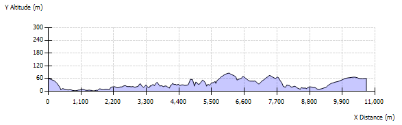
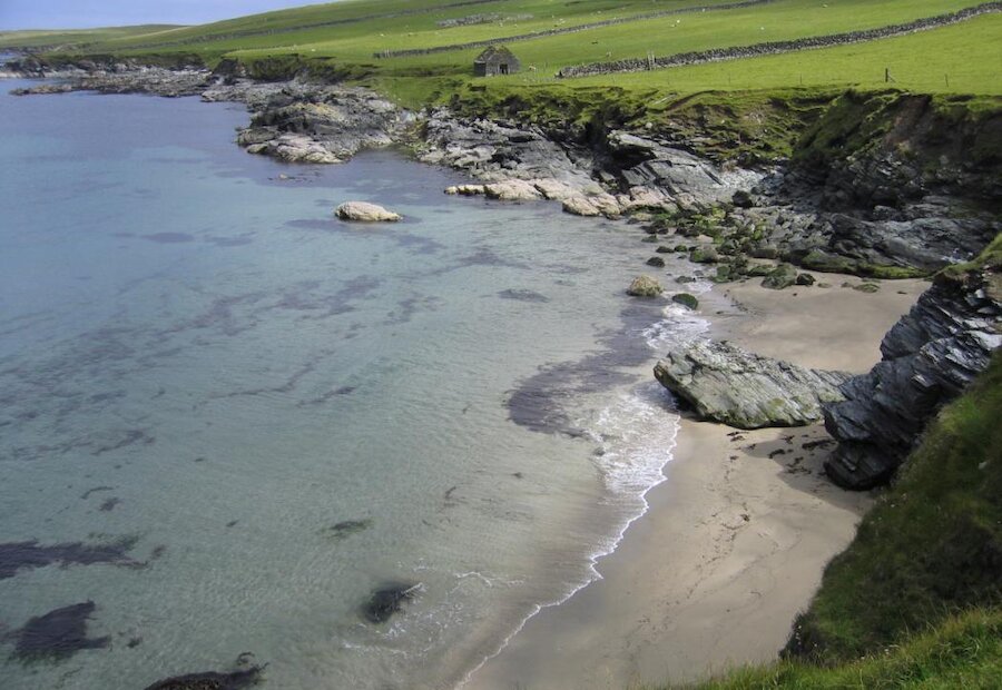
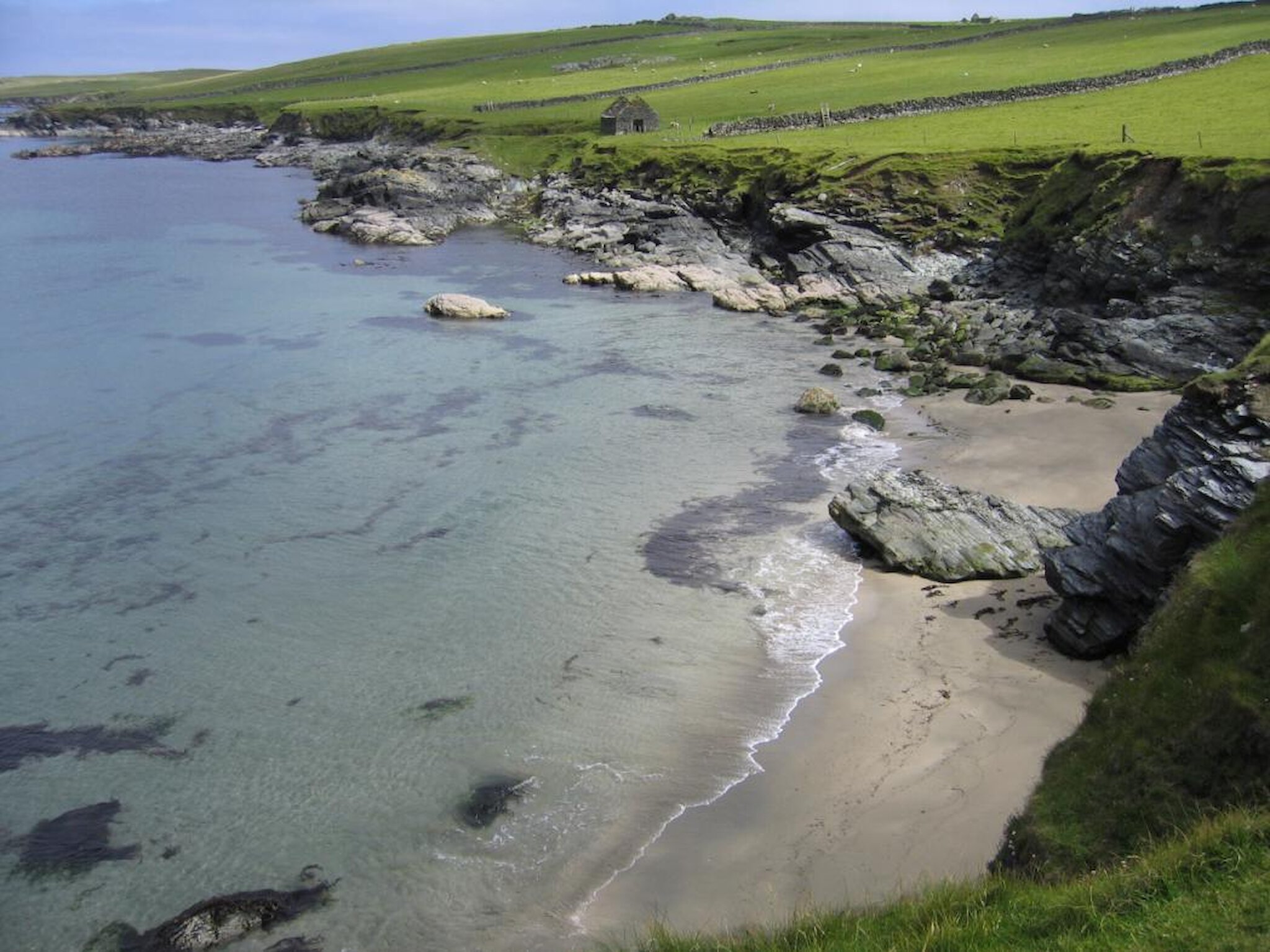
This is a long circular walk along some of the most spectacular cliff scenery in Shetland. The walk starts at the car park by the croft of Everland. From here head down to the shore via the ruined medieval chapel of Kirkhouse then head north along the coast above the small sandy bay known as the Sand of Paradise.
Continue along the coast via gates and stiles in the walls. The impressive ruined building of Smithfield on the hillside was built in 1815 and abandoned in 1870. A burn with a ruined Norse mill runs into the Geo of Hestaness. Here the soapstone (‘kleber’ in Shetland) bedrock shows signs of quarrying in Norse times to make cooking utensils and other artefacts. North of this geo follow the long slope of Hella, then skirt Long Geo with care to round Hesta Ness and Skarpi Geo. Further on at Longa Tonga there is some winding gear left over from soapstone quarrying in the early 20th century.
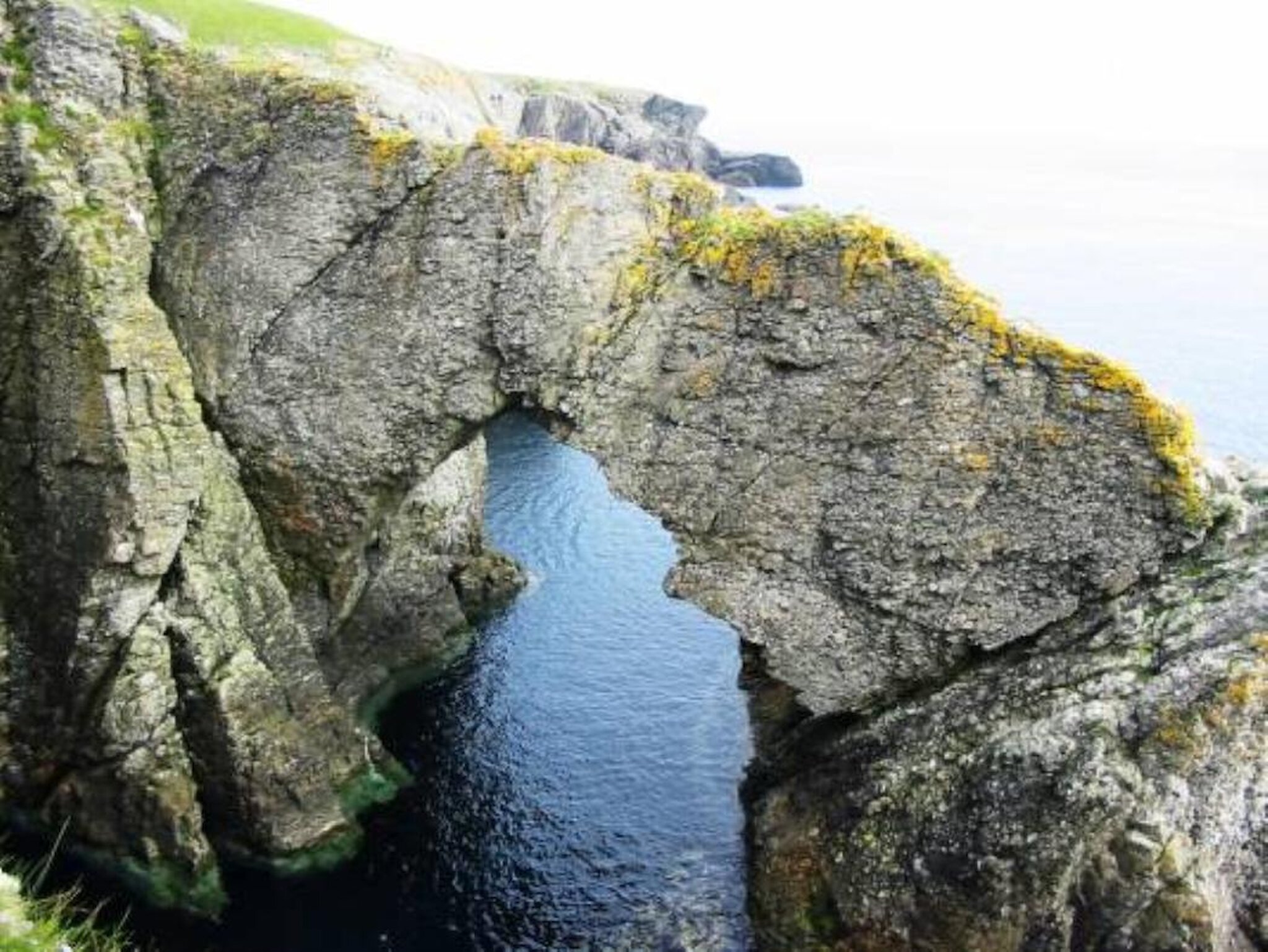
The headland (Ness) of Strandburgh (Strandibrough) is surrounded by a myriad of skerries, sea stacks, caves and arches. Inner Brough is accessed through the ruins of a small building and past hollows and embankments. Outer Brough is an inaccessible sea stack and the cliffs above it should be approached with care.
Strandibrough takes its name from the crofting ‘toonship’ of Strand but there is no evidence of an Iron Age broch that the name suggests. A number of buildings have been recognised on both Inner and Outer Brough. The Strandibrough complex of ruins was the largest Norse monastic cliff top settlement in Shetland. On Outer Brough small structures can be seen near the summit and on the eastern slope,
Head south from Inner Brough along the east coast passing the Head of Cumla then look back to view the natural arches. From the Head of Holsta you can ascend Baa-neap, which is an excellent viewpoint. The descent will take you past Vedders Geo then Heilinabretta where the Danish frigate ‘Wendell’ was wrecked in 1737.
At Trona Mires there is a gate in the fence before the mires. Further south is the burn leading from Trona Mires to the Tind. Here the bedrock shows good exposures of the Funzie Conglomerate. These were originally great thickness of boulders formed by fast flowing rivers many millions of years ago that were buried, heated squeezed and stretched by tectonic movements.
From the Tind ascend Hevda then descend past Houlls Geo and Nousta Ness to join the Funzie Bay. This was the site of a Haaf fishing station during the 18th and 19th Centuries. The ruined building (the Booth) was the home of a merchant cursed by a widow for betraying her sons to the Press Gang. From here take the road through Funzie to the crossroads. Here Geopark Shetland has built an excellent geological model showing a cross-section through Fetlar. The road north leads back to Everland and the start point.