


Directions to start
A regular bus service operates to Scalloway. The timetable can be found on the Shetland Travel Information website.
A regular bus service operates to Scalloway. The timetable can be found on the Shetland Travel Information website.
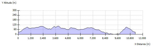
This walk begins at the Doctor's surgery in Scalloway. Take the track up between the hill of Berry and the Hill of Houlland, accessed by a stile and crossing a short stretch of pasture, then joining a farm track. As you climb steadily towards the ridge, take regular breaks to turn round and appreciate the views which open out behind you. From the top, you can look north across the moors towards Tingwall and east down into the valley, across Scalloway itself and eventually south and down Clift Sound. On a fine day you can see Fair Isle.
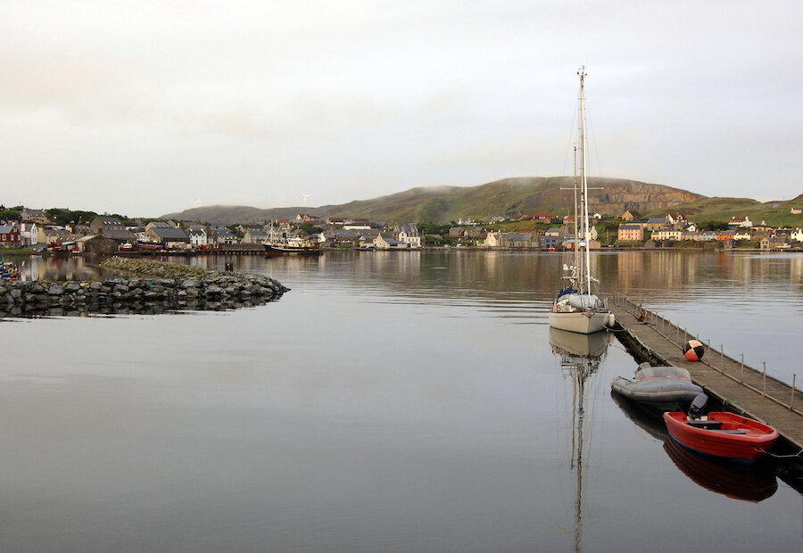
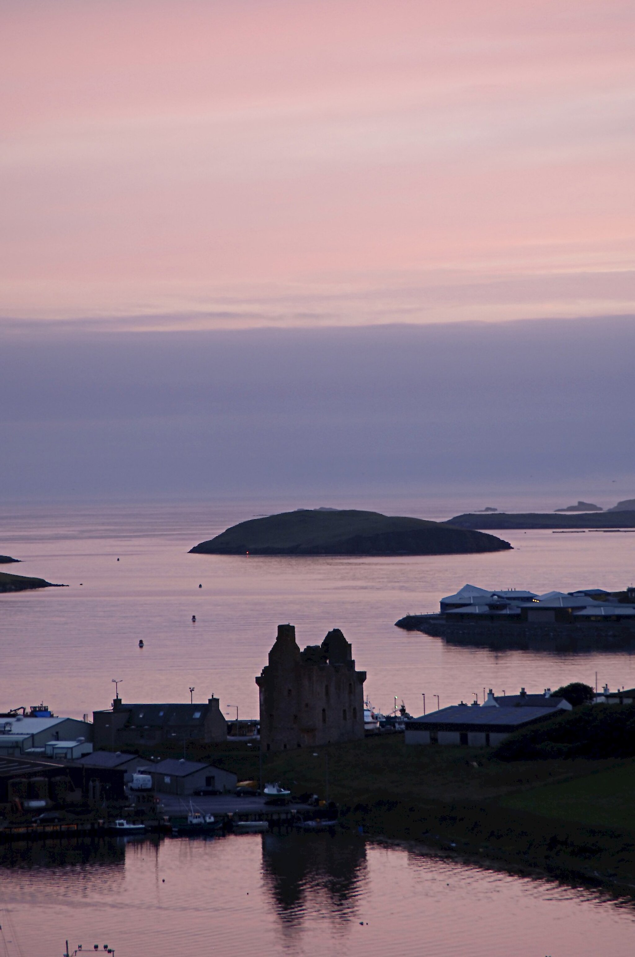
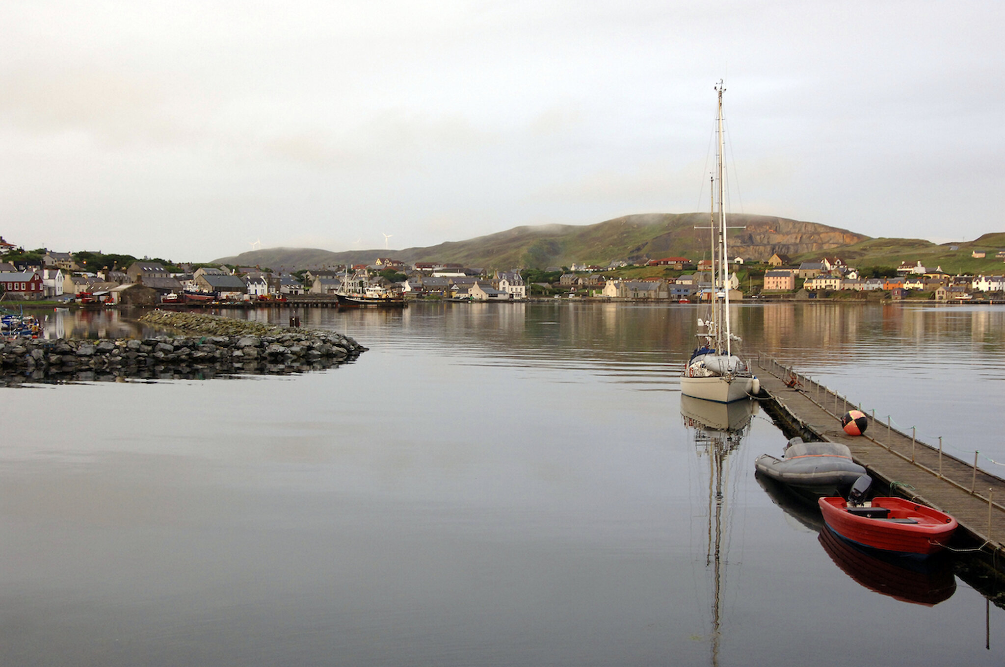
Directly across is the Scord Quarry, eating away at the hill. Below in Scalloway the former capital of Shetland, you can see the castle, built in 1600. The town has grown enormously since those days, spreading back inland, up the hill and now across the far side of East Voe as well. Across to the west lies the peaceful valley of Burwick, with its bay and small island, on which the remains of a broch can be found. The valley floor has a string of lochs, joined by a network of small streams.
The Tingwall valley to the East lies over crystalline limestone, which breaks down to form fertile soils, hence the farms and the green grassy acres. Burwick lies largely over granite, which drains less well and heather and moss cloak the ground, making for less easy walking, but plenty of habitats for wild flowers and nesting and sheltering birds. Frogs too can be found here and large quantities of wild fungi in autumn.
If you wish, you can detour south along the ridge, or follow the track down into the valley. This route heads north along the ridge to the Mill Loch. It then curves around the upper valley floor to Broo Loch and Loch of Ustaness on the hill overlooking Burwick above the far side of the valley. There are several prehistoric sites around the lochs and in the bottom of the valley. A fine Neolithic house site stands between Loch of Broo and Jamie Cheyne's Loch.
As you pass Maggie Black's Loch, take a minute to look west across the sea, to Langa, Linga, Hildasay and the other "Scalloway islands". Descend to a farm track into the valley, but look out for yet another Neolithic house site, an even bigger one, not far west of the Loch of Houlland, said to be one of the best in Shetland. There are several burnt mounds in the valley, to the west of the Loch of Burwick.
Several crofts to cultivate the land here in the past, but only one remains active. Several buildings still remain here, including a recent one. At the end of the Ness of Burwick a busy fishing station once thrived. Little is left of its splendid pier and work area now, but it is well worth a visit. Take the track back up the Hill of Houlland to return to Scalloway.