


Directions to start
The start point of this walk is not accessible by public transport, so we'd recommend travelling there by car.
One of Shetland’s wildest and most challenging walks.
The start point of this walk is not accessible by public transport, so we'd recommend travelling there by car.
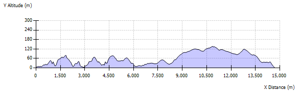
This is one of Shetland’s wildest and most challenging walks. The outward leg follows a dramatic coastline ascending and descending very steep slopes into and out of glaciated valleys. The return leg is in part along a track through a fabulous moorland landscape. Please note that it not considered safe practice to descend the cliffs and cross the sandbar to the island of Uyea.
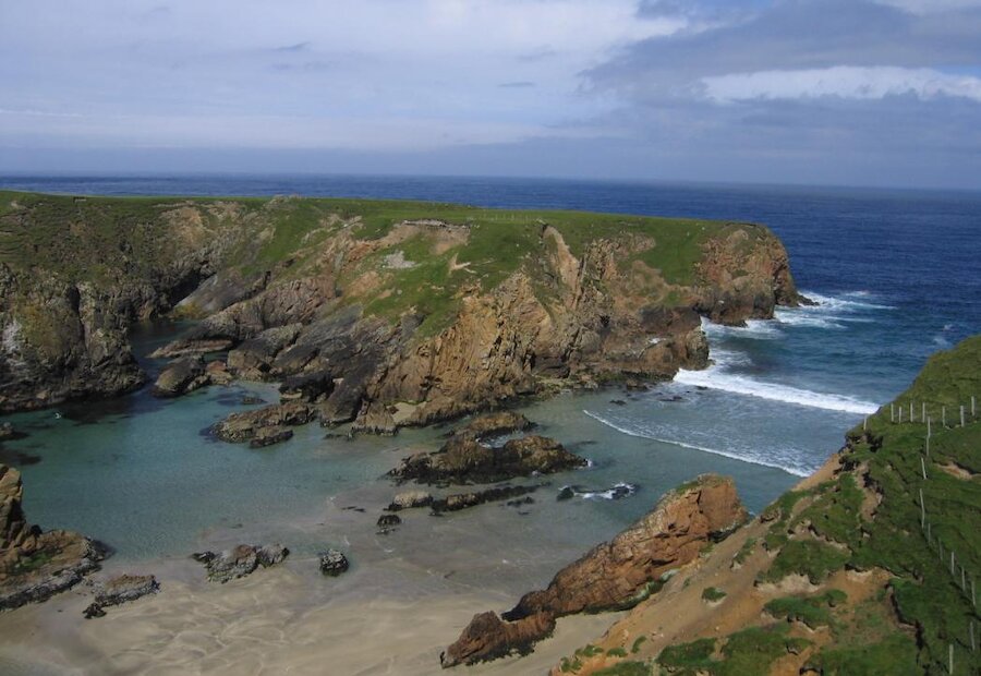
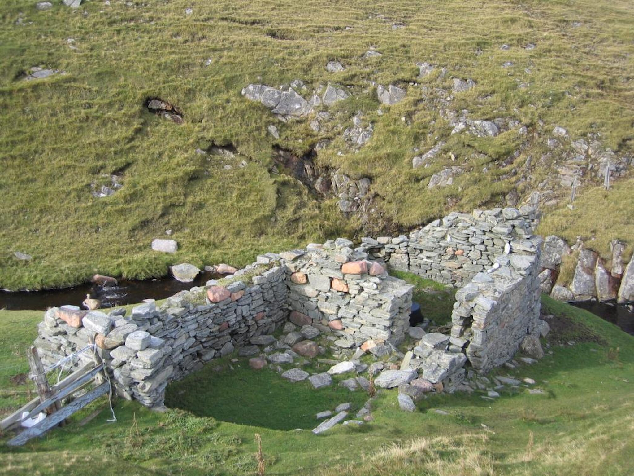
The start point for the walk is the west end of the beach at the head of Sand Voe. From here follow the east shoulder of the hill north then west above the shore of Sand Voe. From the north shoulder of the hill there is a steep descent to the beach at the inlet of Roer Mill. Roer Mill beach is the only safe landing place along the ferocious coast between Uyea and Sandvoe. The ruined building is a Haaf fishing böd. Sixareens (open fishing boats) from Uyea brought their fish to Roermill where there was a better beach for drying the fish.
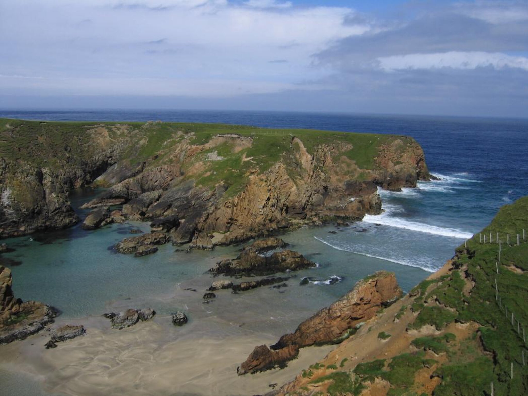
From Roer Mill ascend Heoga Neap for spectacular views of both hill and coast, then skirting the cliffs above Raa Wick descend the broad headland of Grut Ness down to the inlets of Wilgi Geos. The rocks in the Sand Voe to Uyea area are 2500 million-year-old gneisses. Mostly granite-like in origin these rocks have experienced numerous upheavals in the Earth's crust or 'mountain building events’ that have deformed and metamorphosed the rocks. At Wilgi Geos these rocks have been spectacularly cut by later injections of magma to form the contrasting red and black composite dykes.
From Wilgi Geos ascend and descend Calder’s Head then follow the cliffs west around the north shoulder of North Hill passing the ruined croft of Brevligarth. A track takes you from North Hill down to the ruined crofting toonship of Uyea. In 1851 all 11 houses were occupied but most were derelict by 1906.
Leaving Uyea crofts head north past the cliffs of The Breck then west to the ruins of Uyea Haaf station lodges at North Wick. The sixareens left from Uyea but returned with their catches to Roermill. Follow North Wick around to Uyea Ayre. This is the sand bar (tombolo) across the mouth of Burrier Wick and is covered at the highest tides. Follow the cliffs south around The Ness to get great view of the opposite shore of Uyea.
For the return leg head south-east across the moorland to the Uyea crofts then pick up the metalled track that winds its way south-east across the moorland towards North Roe. This track will take you between Innis Loch and Mill Loch where you may encounter Golden Plover, Red-throated Diver and Arctic Hare. To the south is the red granite (granophyre) scarp of the Beorgs of Uyea where plug of magma forced its way into the metamorphic rocks some 360 million years ago.
Beyond Pettadale Water the track will take you across the Burn of Sandvoe and on towards North Roe. From North Roe follow the road north back to the sart at Sandvoe.