


Directions to start
Papa Stour is accessed by ferry. Take a look at the timetable to plan when best to travel, as there as limited sailings.
Papa Stour is accessed by ferry. Take a look at the timetable to plan when best to travel, as there as limited sailings.
Papa Stour is an island situated in St Magnus Bay and can be reached by ferry from West Burrafirth or passenger aircraft from Tingwall. Please note that there is no overnight accommodation or shop on the island but there is a campsite. The myriad of sheer cliffs, geos, skerries, sea caves, stacks and natural arches have won Papa Stour international recognition as a Special Area of Conservation. Common and Grey seals are found in large numbers around the island and otters breed on the island. There are 18 species of nesting sea birds and the island is an ideal environment for ground nesting birds. A wide variety of wild flowers and lichens are also found.
From the ferry pier on Housa Voe follow the tarmac road west then south to the Biggins. This is the possible site of a stofa (traditional house) belonging to Duke Hakon of Norway and a modern reconstruction has been erected near the site. A little further on leave the road and follow the track to the shore at Kirk Sand. The Kirk on the right of the path was erected in 1806 and has a stained glass window by the artist Victor Noble Rainbird and is the only surviving example of stained glass work by the artist.
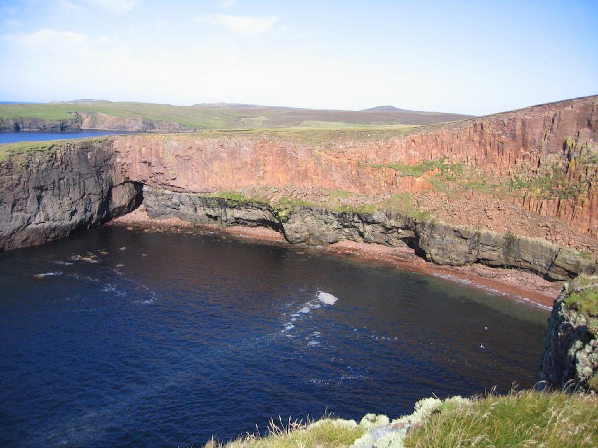
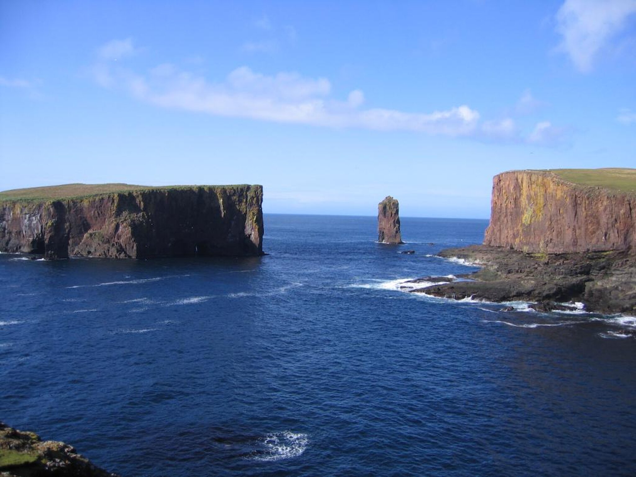
From Kirk Sand follow the cliff tops south then west crossing fences as necessary by the stiles provided. There is a subterranean passage and collapsed cave at Clingri Geo. Papa Stour is mostly composed of lavas from a volcanic eruption some 360 million years ago when ‘Shetland’ was south of the Equator. From Gorsendi Geo the cliffs are composed of bright red rhyolite lava that has spewed out across desert sandstone. An excellent view of caves in the cliffs can bee seen from the Shepherd’s Taing. A detour to the summit of the Hill of Fielie gives great all round panoramic views.
Descend the Hill of Fielie passing through the ‘Hill Dyke’ that used to separate cultivated land from hill pasture. Mo Geo cliffs are of spectacular red rhyolite. From here follow the shore below the north-west shoulder of the hill, some of the ruins here are believed to be that of a leper colony. Mounds of turf here and elsewhere are soil scalpings. Continue around the shore of Hamna Voe visiting the ruined water mills at the head of the voe and the ruins of Hamnavoe’s 19th Century fish curing station on the west side of the voe. From the ruins continue to follow the cliffs past the sheep wash on to the headland.
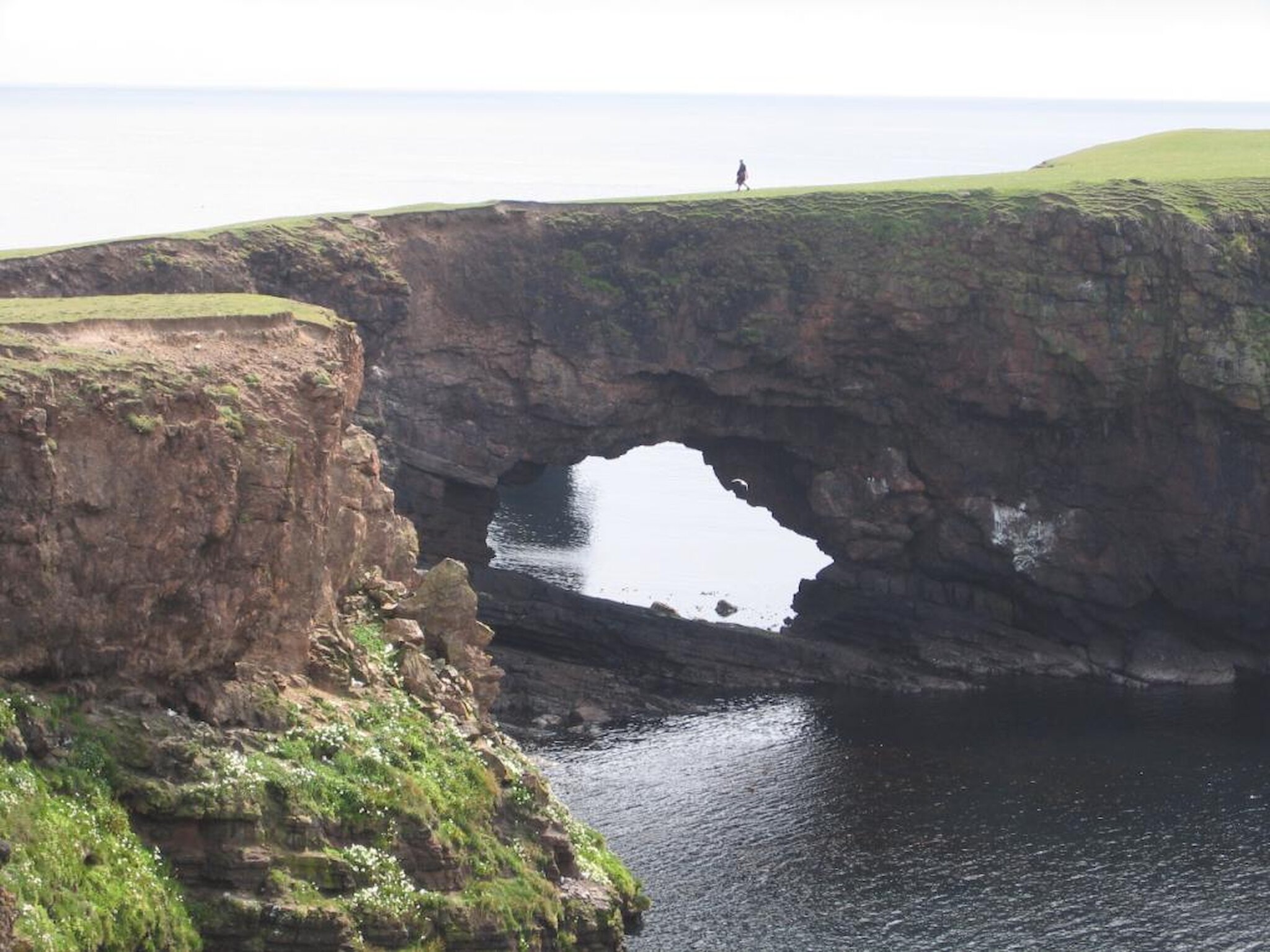
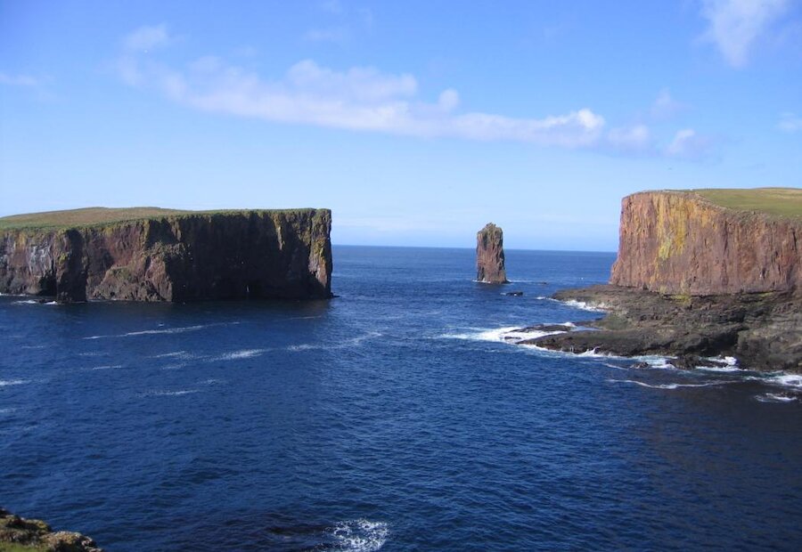
From this headland the walk north-west along the cliff tops to Aesha Head reveals a stunning and dramatic variety of caves stacks, skerries and natural arches. Kirstan's Hole provides a spectacular example of a geo with tunnels and collapsed sections of a cavern. Erosion along a line of structural weakness has not only cut geos and caverns but also undermined the overlying ground, producing a sequence of depressions filled by shallow lochs on the surface. One of these lochs drained in 1981 when its floor collapsed into the cavern below.
Beyond Aesha Head ascend Stour Hund for spectacular views from the cliff top of Fogla Skerry and Lyra Skerry then follow the cliffs north-east to Akers Geo. From Akers Geo there is a steep climb to the summit of Virda Field for a great view of St Magnus Bay and the treacherous reefs of the Vee Skerries.
Descend Virda Field to the Geo of Bordie. From here follow the shallow valley south-east passing between the two lochs beyond Sholma Wick. Continue south-east passing ruins of Neolithic homesteads and Bronze Age brunt mounds to meet a metalled track north of Gorda Water. This track joins the main road at Hurdiback, which you can follow to the start point.