Directions to start
This walk is easily accessible by public transport, and the local bus timetable can be found on the Shetland Travel Information website.
This walk is easily accessible by public transport, and the local bus timetable can be found on the Shetland Travel Information website.
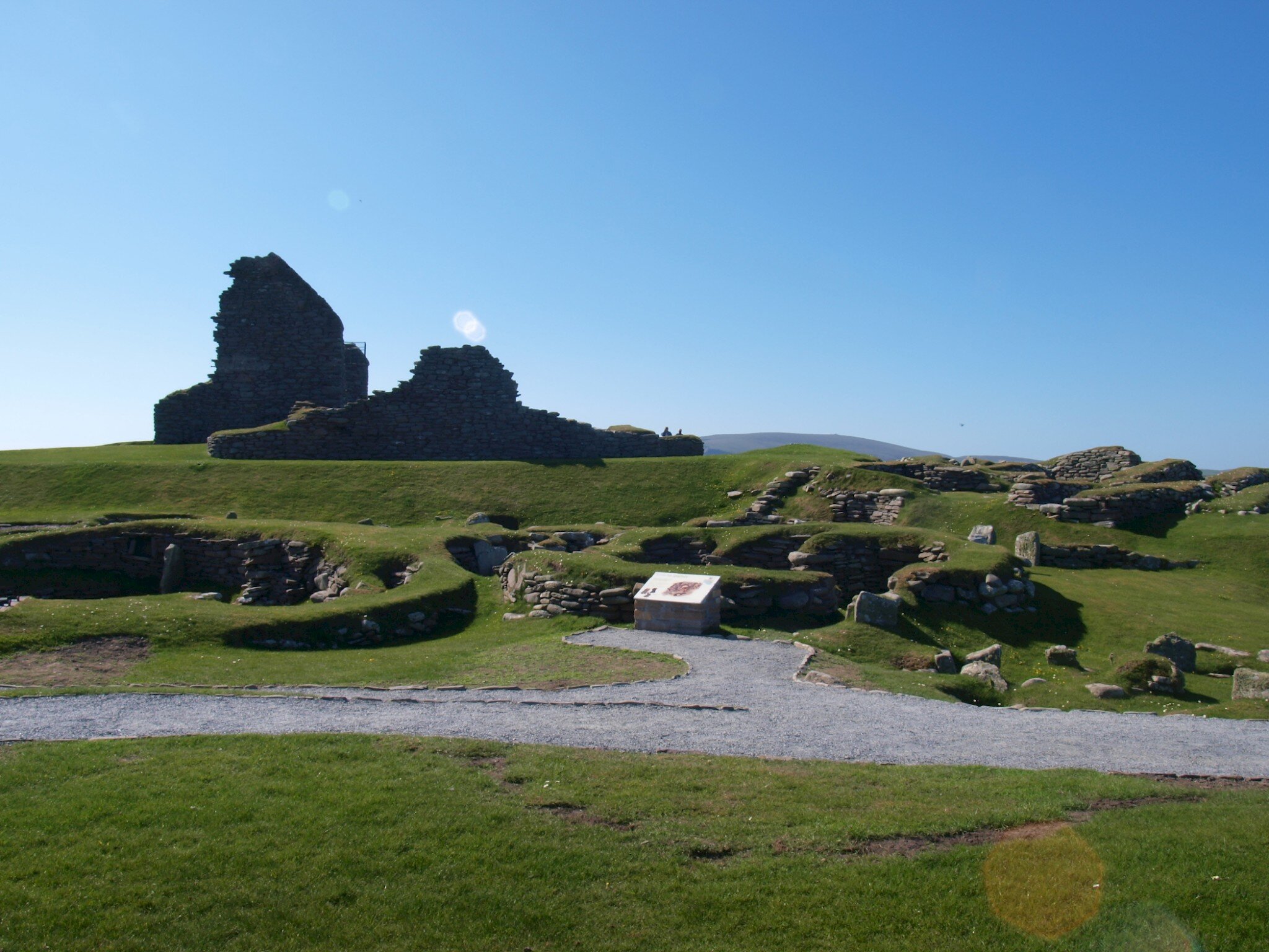
Start at Jarlshof and take the gate into the field along the shore to the south of the Sumburgh Hotel garden. There has been some coastal protection work done here. Follow the coast eastwards but watch your feet if the grass is long, as it may conceal large sea-thrown boulders. The cliffs are fairly low to begin with, but they gradually rise and grow more dramatic. You will pass a number of well built cairns at intervals, said to have been built by a tourist while waiting for his wife to finish painting the scenery. Good stiles and access aids have been constructed along the route.
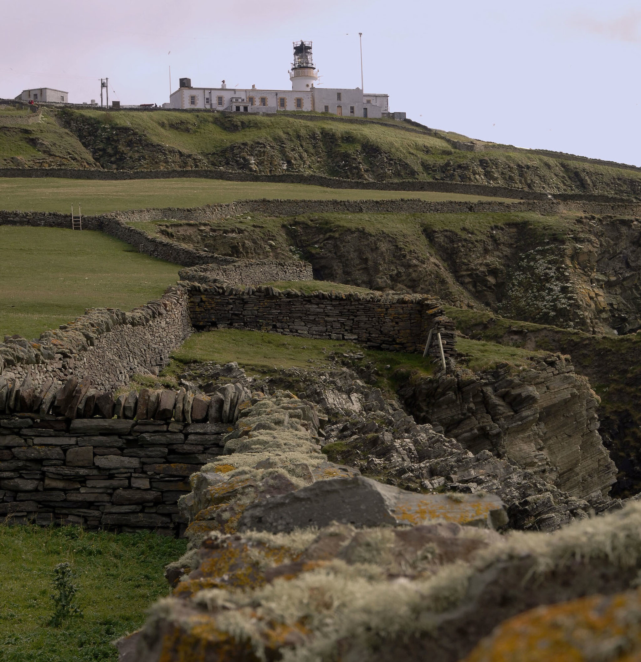
The view ahead is dominated by the cliffs of Sumburgh Head with its crowning lighthouse and rising sweep of grassland. In spring the green turns pink with seapink flowers. In clear conditions, Fair Isle is visible against the sea horizon to the south. Climb steadily towards the single track road which winds up to the lighthouse and stop at the car park to read the information displays. Between May and late August you could see puffins, as well as many other sea bird species. If you are really lucky, you may catch sight of whales from here too.
A detour around the lighthouse buildings can be rewarding, with spectacular views and cliff scenery, but keep well back from the edges. Looking from Sumburgh Head north to Compass Head, you can clearly see the bedding planes of the underlying sandstone like rows of buried shelves under the turf. Once part of an ancient lakebed, these rocks have been tilted up at an angle, allowing their exposed faces to erode into ideal ledges for nesting seabirds.
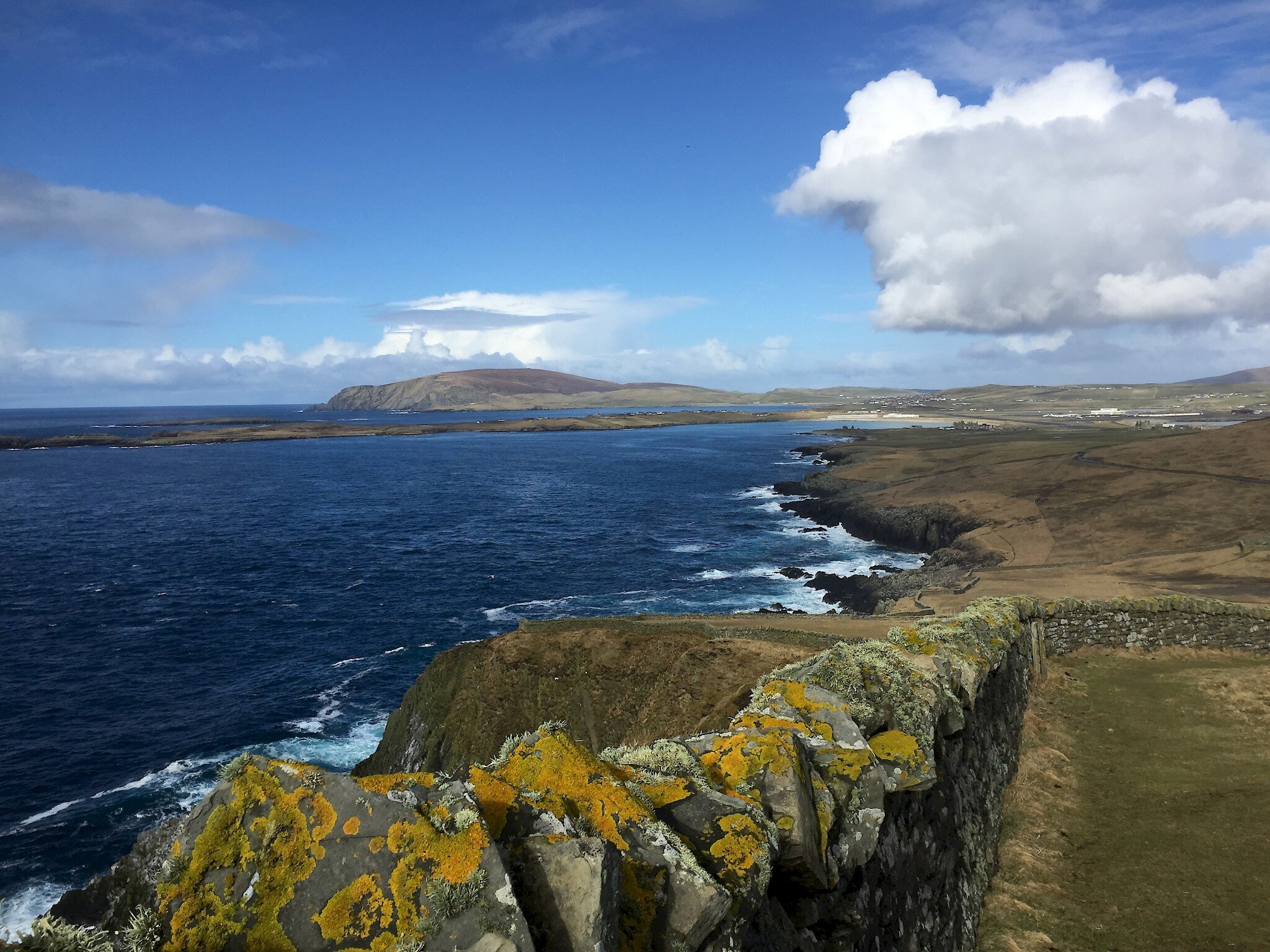
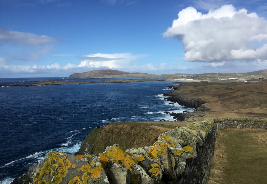
From the bird watchers' car park, you now head north along the cliffs, climbing steadily until you reach Compass Head itself. Muldri Geo and the Slithers make for dramatic photographs, where waves crash against their lower rocky faces. Seals bob up and down among the swirling seaweed "forests" below. Stop and get your breath back at the top and enjoy more stunning views across the Pool of Virkie, right up to Noss and Bressay in the north and west to Scatness, Fitful Head and uninhabited Lady's Holm and Horse Island.
From Compass Head, descend carefully towards the lower slopes. Beware of crumbling edges and concealed uneven ground. You may see aeroplanes landing and taking off from Sumburgh airport. Sumburgh Hotel, Sumburgh Farm and Jarlshof can be seen clearly from here. There are some quarries on the way down, where migrant birds often take shelter. At the foot of the slope, you can make your way back to the road and peep into the beautiful walled garden at Grutness, or, clamber right out across the boulder storm beach to the Scult of Laward. There is a fine sandy beach at Grutness, where you can shelter during westerly winds. It is only a five minute walk from here back to the beginning of the walk at Jarlshof.