


Directions to start
There is a limited bus service that will take you close to the start of this walk route, but we'd recommend travelling there by car.
There is a limited bus service that will take you close to the start of this walk route, but we'd recommend travelling there by car.
This walk can be circular as described or made linear by descending Sandness Hill to the settlements of Norby and Sandness. The start point is the west end of the scenic Dale of Walls where the main road ends at Netherdale public telephone. From Netherdale follow the Burn of the Dale west to the Voe of the Dale. In summer there are a profusion of wild flowers that grow along the banks of the burn.
At the Voe of the Dale the island of Foula provides a magnificent backdrop to a nice shingle beach at the head of the voe. This is a favourite haunt of seals and otters. On the south side of the voe there are stone built boat ‘noosts’ where open boats were drawn up for shelter from winter storms. This was a summer Haaf (deep water) fishing station in the 19th Century. Some of the structures were originally lodges in which the fishermen stayed and the beach was where the fish was dried after salting.
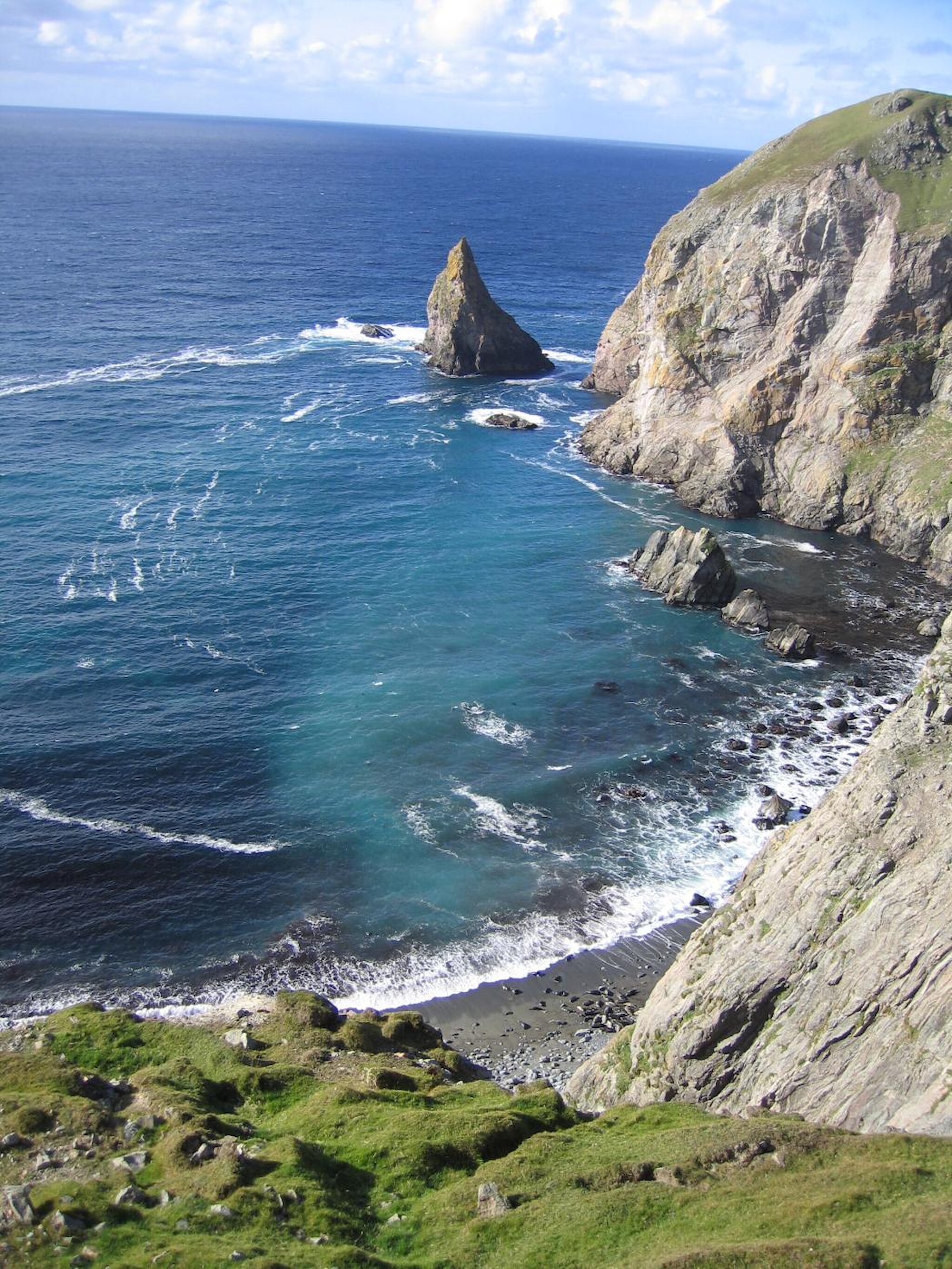
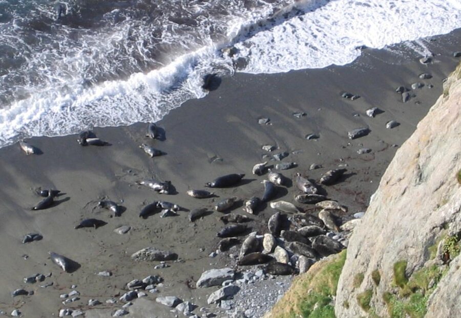
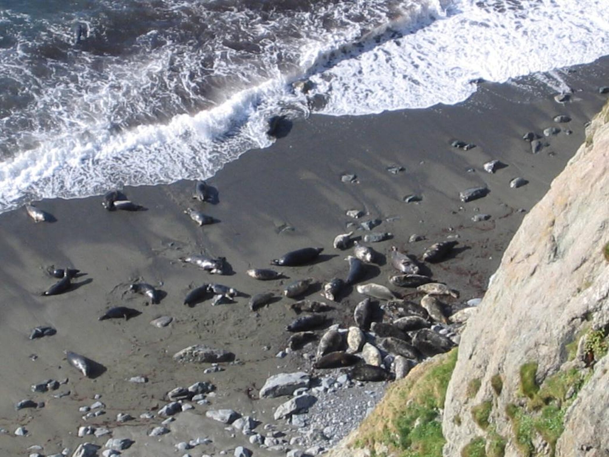
Continue west along the north side of the voe to Mu Ness then swing north-west across the shoulder of Blouk Field above Coppa Wick. Continue to follow the cliff tops around Weinnia Ness and past the sharp ridge of Steis Point to Sel Ayre. This coastline displays numerous natural arches, sea stacks and skerries. Sel Ayre literally means seal beach and is a favourite haul out spot for seals. At the north end of Sel Ayre is the jagged pyramid of Erne’s Stack, once the home of a White Tailed Sea Eagle. These became extinct in Britain when the last one was shot in Shetland in 1918, but subsequently have been successfully reintroduced to mainland Scotland.
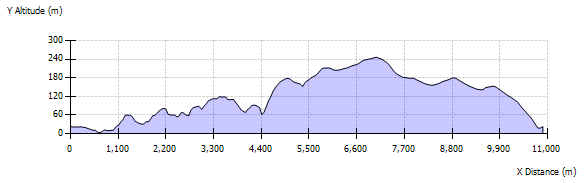
From the cliffs north of Sel Ayre there is a steep descent into and steep climb out of Deep Dale. Deep Dale is a glacial meltwater channel. Meltwater channels such at this are often very large relative to the streams that now occupy the valleys; such the streams are regarded as too small to have cut the valley. The ascent out of Deep Dale will take you to on to the 160m cliff top of Banks Head and a magnificent view back along the coast you have walked. The cliffs of Banks Head and the coast are sandstone, now folded, that was laid down in streams and rivers almost 400 million years ago.
From Banks Head turn east to ascend the summits of Ramna Vord and Sandness Hill. Here you may encounter Golden Plover, Red-throated Diver and Arctic Hare. Sandness Hill is the highest hill in the West Mainland and on a clear day gives excellent views of Papa Stour and St Magnus Bay to the north, also much of the South and West Mainland. From the summit head south skirting Deep Dale, then south-west crossing the summits of Dale Hill and Blouk Field. From Blouk Field you can descend to the start point at Netherdale.