Directions to start
Culswick is not directly accessed by public transport, so we'd recommend taking a car to the start point of this walk.
Culswick is not directly accessed by public transport, so we'd recommend taking a car to the start point of this walk.
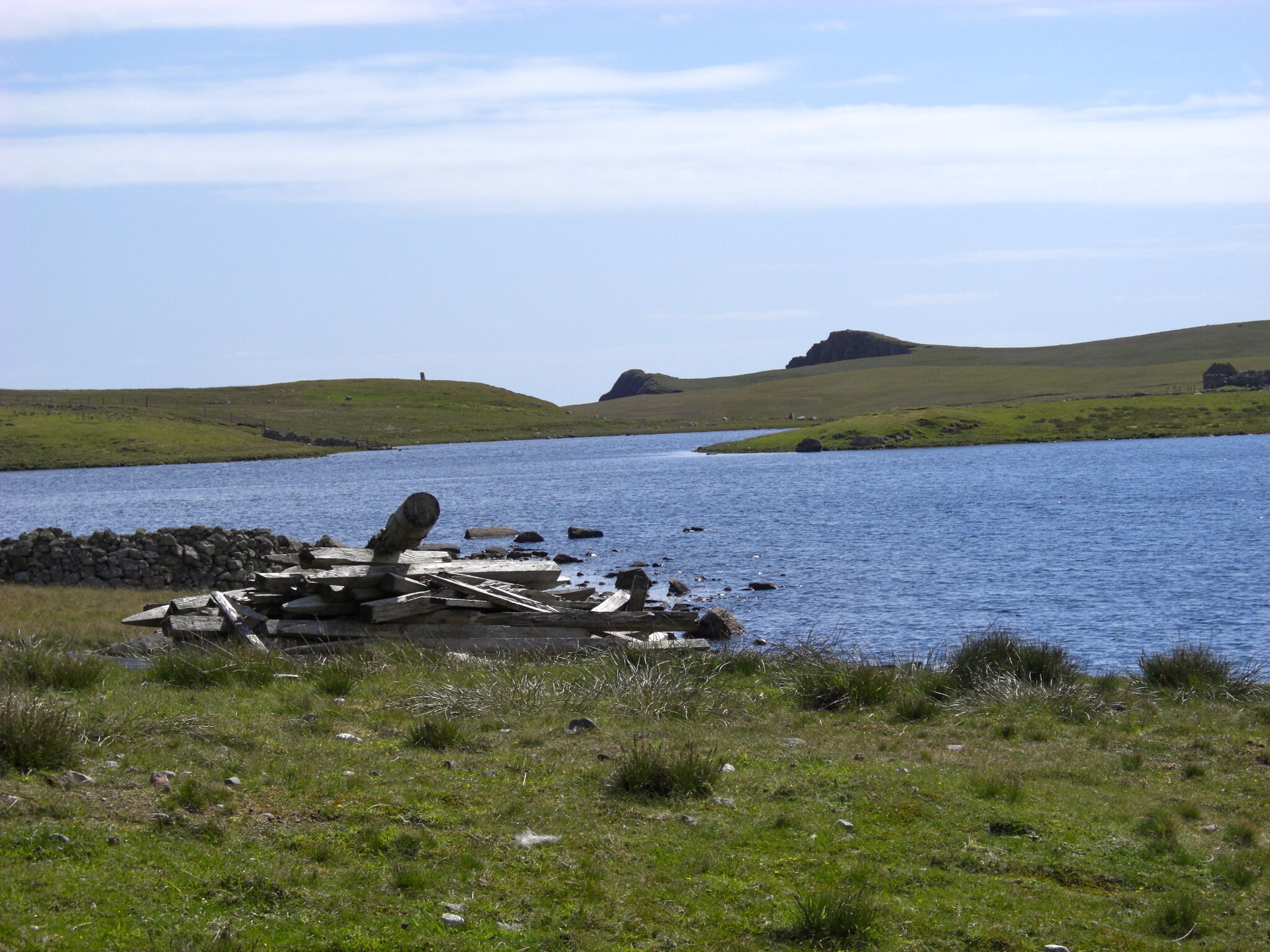
This is one of the finest walks on Shetland's West Side. The Culswick road branches off the single track road between Skeld and Bridge of Walls, then forks, the left route leading to Crogran on the east side of the valley. Take the right fork into Culswick and enjoy spectacular views of the dramatic valley here, which narrows, the hills rising as they reach the cliffs. The valley floor was once a sea loch, now blocked by a shingle bar, creating a fine fresh water loch.
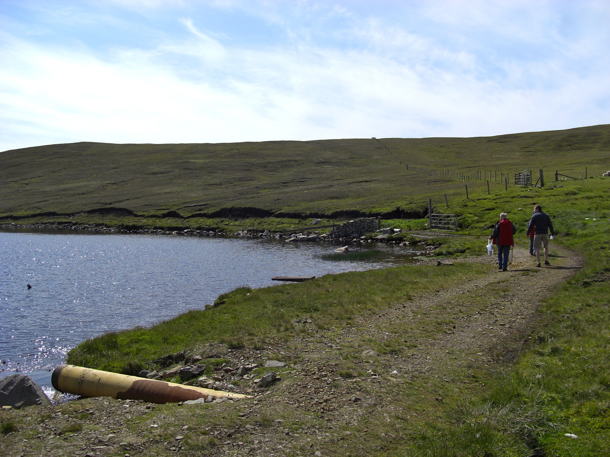
Shortly before the end of the road, the route to Culswick Broch begins along a track leading to the right, uphill to a small Methodist Chapel. Two peat tracks branch away from the chapel across the hill. Take the right one, which heads west and leads to past the Loch of Sotersta in the valley below. Leave all gates along this walk as you find them. In spring and summer the air here is filled with the calls of lapwing, curlew and ringed plover.
As you descend, you pass several sturdy planticrubs (plant shelters) and old kale yards, built of local stone, which is very close to the surface here. These bear witness to a time of intensive crofting in the past. At its lowermost point, the track can be very wet and muddy as it passes between high peat banks. As the track climbs again, there are glimpses of deserted Sotersta and the high sea cliffs beyond, with standing stones visible against the distant horizon.
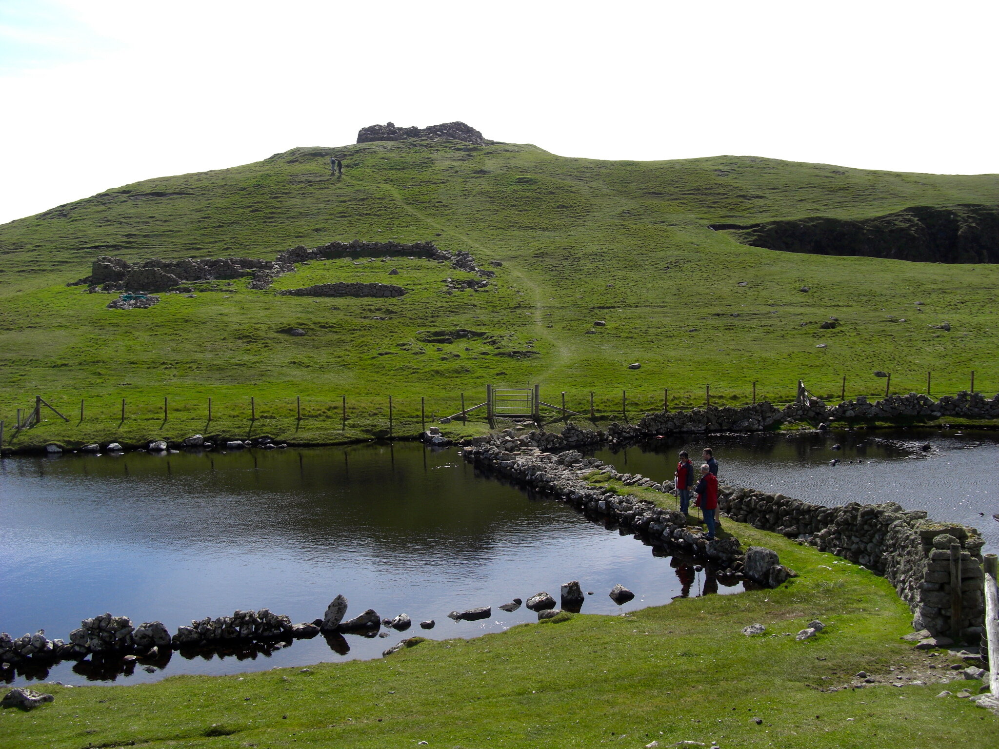
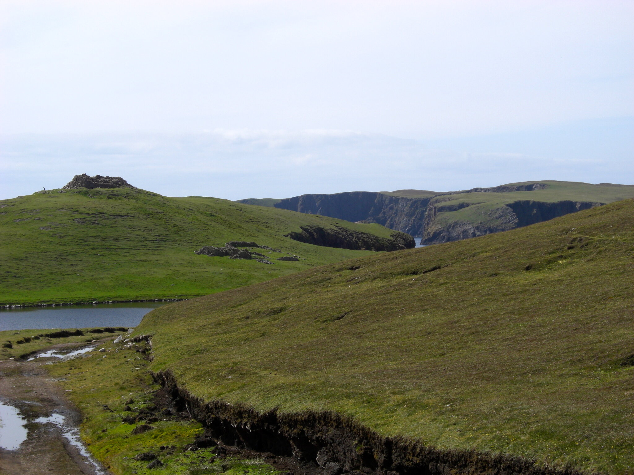
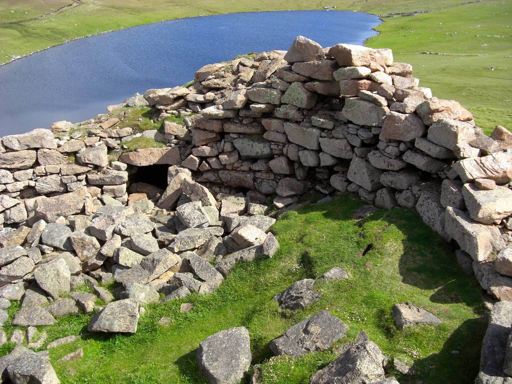
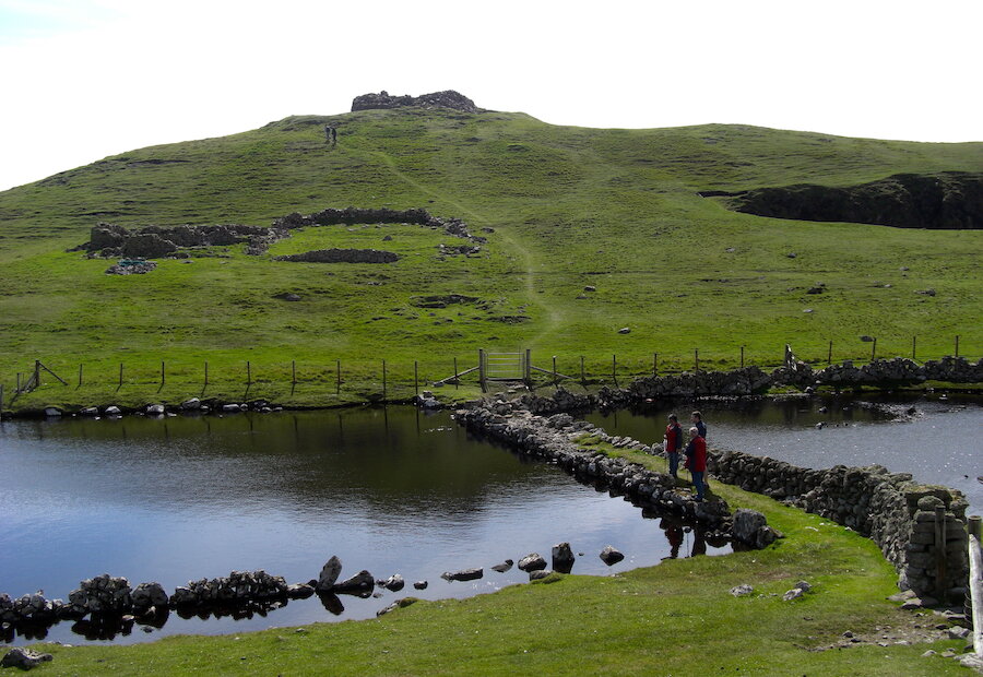
The track reaches another watershed. Culswick Broch and ramparts appear ahead, stark above the Loch of the Broch, with Vaila and Whites Ness and the sea beyond. At the end of the track, head downhill, cross the causeway, the fence beyond it and climb past the ruined crofthouse to the broch above. It stands in a tumble of blocks and though robbed long ago of much of its masonry for local buildings, is still impressive, with its massive triangular lintel stone and some internal chamber structures are still visible.
From here you can retrace your steps along the track to the Culswick road.