The ferry terminal was constructed with rock from an adjacent quarry cut through serpentine rock. Walk north from here alongside the road to the track which turns west down to the sea. Follow the coastline to Hoga Ness. You will pass the recently restored Belmont House which may be open for visits, if you have time. The broch site at Hoga Ness is dramatic and well worth exploring, before you head north across the hill towards the ruined croft buildings on the skyline. An Unst heroine, Grace Petrie lived here once, famous for her daring rescue of the crew of a vessel in trouble in Bluemull Sound.
From here you head north again, where the huge scattered stones of a possible chambered cairn are worth examining. The ruins of Braeside are passed nearby and then you descend to the shore at Snarra Voe, and the empty shell of the former shop and side school. From here, the abandoned settlement is seen on the south facing slopes opposite, and further to the west, traces of prehistoric structures are visible in the turf. The route round the shore and up to the settlement can be muddy in wet weather, and you may need to keep to the shingle beach to start with. Look out for waders around the shore here.
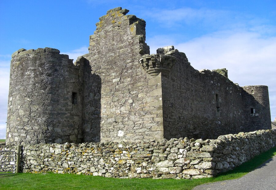
From ruined Snarravoe the route heads uphill and north across the moors to Snabrough one of Shetland's best kept secrets. Keep to the west shore of the small loch here. With its massive broch ramparts and cluster of croft buildings this place has a wonderful atmosphere. There are fine views from the high ground to the south of Snabrough, right across southern Unst to Fetlar. To the north of Snabrough the ground falls away gradually and the whole of the rest of the route is laid out before you. Lund Kirk, the cemetery and the fine beach lie between the massive headland of Bluemull to the west and the gaunt remains of the supposedly haunted house of Lund to the east. Straight ahead in the far distance lie the heights of Valla Field and the Broch of Underhoull, with the excavated Norse farm site close by.
Descend to the Lund Kirkyard and look for the Hanseatic gravestones and the Pictish symbol stone in one of the ruined kirk window lintels. There is a good track up to the house, which continues to the main road. A very fine standing stone can be seen beside the road near the junction. If time and energy permit, detour towards the Westing and explore Underhoull Broch, built on a vantage point overlooking southern Unst and the northeast side of Yell.


