Crossing from Yell to Unst, this route heads to the most northerly of the Shetland Islands and the most northerly section of the UK’s National Cycle Network.

Mid Yell - Baltasound/Norwick

Cycle Information

flagArea
Unst, Yell
info-circleRoute Type
Linear
cycle-distanceRoute Distance
23.5km / 14.6 miles
downloadGPX File
downloadKML File

With two islands to cover, this is a rewarding journey, with just over 7 miles (11km) before the ferry crossing at Gutcher and a further 7 miles (11km) from Belmont to Baltasound after the short crossing.

Baltasound is the main settlement in the centre of Unst. The village is some 5 miles (8km) south of Norwick, where the National Cycle Network ends and some 7 miles (11km) from Skaw, which is the final end point of the UK’s public road and location of the northernmost inhabited house. You are very likely to wish to continue north to these destinations and the day ride from Baltasound to Norwick and Skaw can be added to this route in order to do just that.

The B9081 takes you from Mid Yell to join the A968 at the head of the voe. Heading north on the A968 through Camb the route makes a long climb up Basta Hill. From the top of Basta Hill there are great views over Basta Voe, Burra Ness and beyond to Fetlar and Unst. There is now a long downhill past Colvister to the bridge at the head of Basta Voe followed by a climb up again to Sellafirth with views south-east towards Hascosay. The road dips down through Sellafirth and up again as it swings north-east towards Gutcher.

From the ferry terminal at Gutcher you can cross to either Unst or Fetlar. The ferry to Belmont on Unst takes just 10 minutes and runs at intervals of between 25 and 85 minutes depending upon the time of day.

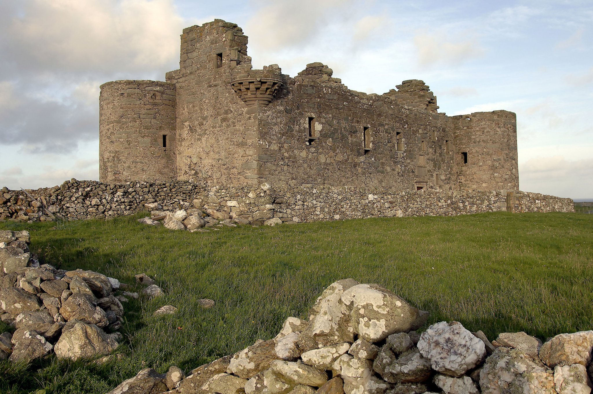
Around 2 miles (3km) from Belmont there is an option to turn right for Uyeasound and Muness Castle. The Castle, Britain’s most northerly, is a ruined 16th century fortified house now in the care of Historic Scotland will be a 3 mile (5km) deviation off the route.

From the Uyeasound junction north to Baltasound the road is fairly straight with no steep climbs. The view from this route shows the contrast in the landscape from the steep heather covered hills to the west and the comparatively flat, poorly vegetated ground to the east. This contrast is due to the change of the islands bedrock from east to west; in the west the bedrock was once continental crust of ancient North America, while that in the east was oceanic crust beneath a long vanished ocean. The amazing geology of Unst is explained at the Heritage Centre in Haroldswick and by Geopark Shetland’s geo-wall and their ophiolite trail booklet and interpretive panels.

We would certainly recommend adding the Baltasound to Norwick and Skaw section to this route. There is much more to see and do if you take the roads north towards Haroldswick, Saxa Vord, Norwick and the beautiful bay at Skaw where the journey has to end. The famous bus shelter on the outskirts of Baltasound is a ‘must see’ and there is the Unst’s mining history to find out about at Hagdale Horse Mill. At Haroldswick there is the Viking Unst longhouse and longship and further around the bay is the wonderfully informative Boat Haven as well as the nearby Heritage Centre.

A steep climb up the old military road will take you to the top of Saxa Vord hill for the most spectacular views south across to Mainland and north to Muckle Flugga. Further on there are the wonderful golden sand beaches of Norwick and Skaw to look forward to.

Search our cycle routes