Hillswick - Heylor, North Roe and Isbister

Cycle Information

flagArea
Northmavine
info-circleRoute Type
Circular
cycle-distanceRoute Distance
42km / 26.1 miles
downloadGPX File
downloadKML File

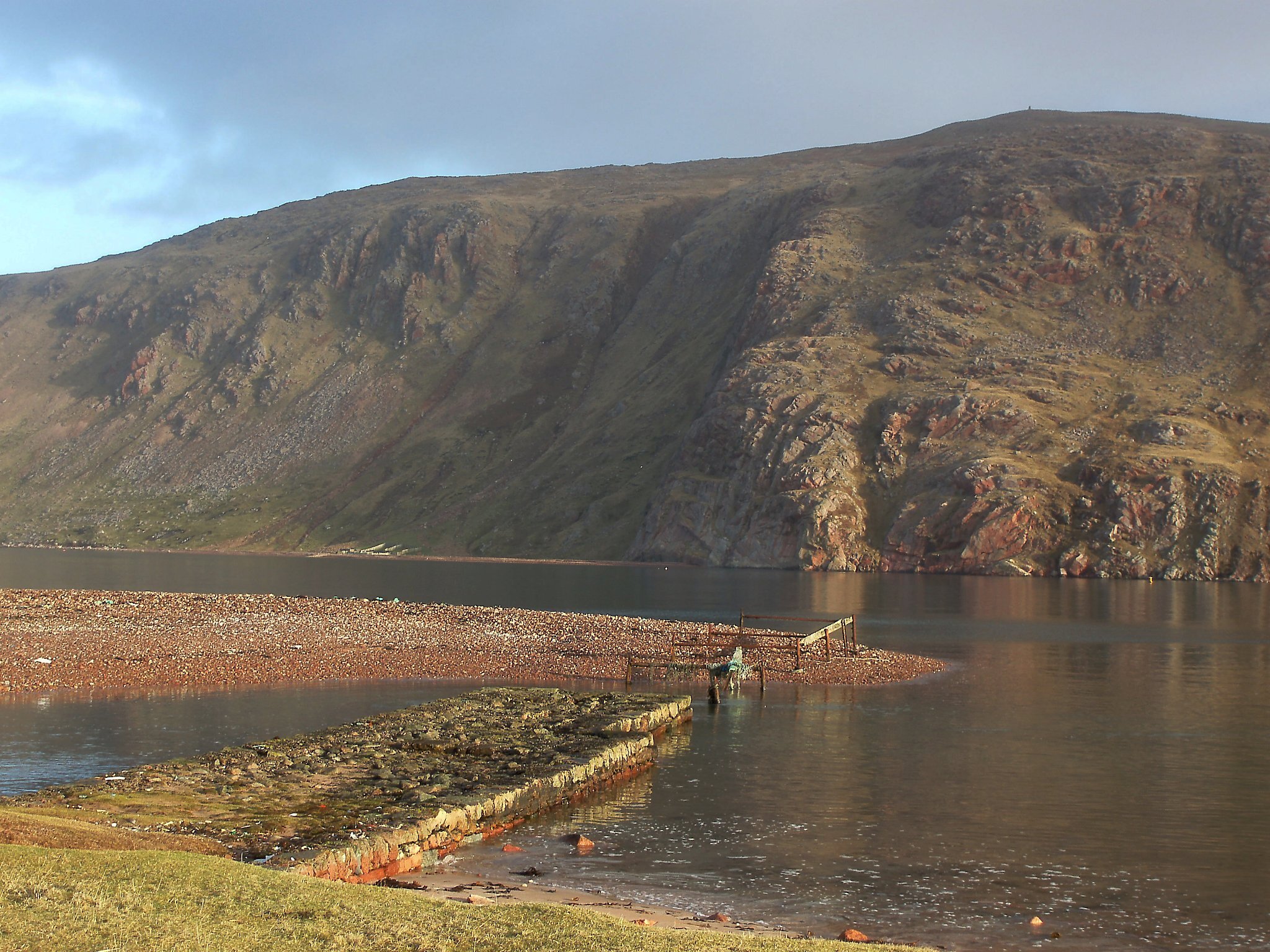
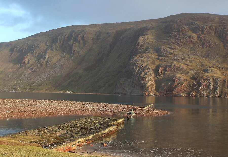
From Hillswick the route follows the A970 for 1.5 miles (2.5km) to Urafirth to make a right turn on the single-track leading to Heylor and Swinister. After about 0.5 miles (1km) the road forks. Take the ‘dead-end’ fork to the left for about 1 mile (1.5km) and down to the shore at ‘The Blade’. This affords the best view of the steep, ice carved, bright red cliffs on Ronas Hill that plunge into the deep waters of the fjord of Ronas Voe. The ruined buildings and jetty at The Blade are from the 19th Century herring fishing; please note that the shingle spit beyond the jetty is a nesting site for arctic terns in the summer and should not be walked on when the birds are nesting.

Returning to the road fork there is 2.5 miles (4km) of single track with little in the way of climbs along the scenic south shore of Ronas Voe to join the A970 at Swinister.

The route follows the single-track A970 north for 7 miles (11.5km) to its end at Isbister. This is a relatively flat and sometimes straight route but there are a few short climbs. There is a sharp bend at The Brig as it crosses the Burn of Roerwater that rushes over red granite boulders, followed by a climb uphill above Collafirth Pier. There is a caravan park with toilet facilities at Collafirth Pier.

From the hill above Collafirth the road north allows panoramic views across the islands in Yell Sound to the rugged west coast of Yell. To the left, all the way to North Roe, is the amazing near vertical scarps of ‘The Beorgs’ where a granite intrusion punched its way upwards through the surrounding rocks many millions of years ago. Also on the left, just past the Loch of Housetter, are Neolithic or Bronze Age ruins including two tall standing stones that mark the ‘Giant’s Grave’.

The route runs close along the shore at Burra Voe and a small loch; a good place to catch sight of seals or seabirds. Just beyond the school at North Roe a rough metalled track heads west for 4.5 miles (7km) to the deserted crofting township of Uyea. This track is not suitable for road bikes. Just beyond North Roe a rode to the left takes you on a 0.5 miles (1km) diversion to Sandvoe and a scenic beach. There is a challenging circular coastal walk from Sandvoe to Uyea returning along the track.

From the route end at Isbister there is the prospect of another challenging but scenic walk to Fethaland. Fethaland was one of the largest open sea or ‘Haaf’ fishing stations that operated in the 18th and 19th Centuries. Fishing was by long line from open boats during the summer months and the fishermen stayed in lodges, often far from home; some of the ruined lodges still stand by the shore at Fethaland.

Return via the A970. At Swinister you can choose to go back along the shore of Ronas Voe or continue on to join the Hillswick bound leg of the A970 at Sandy Lochs. The latter option is nearly 3 miles (4.5km) longer with more climbs.

Search our cycle routes