Eshaness is one of Shetland’s outstanding ‘must visit’ destinations.

Hillswick - Eshaness

Cycle Information

flagArea
Northmavine
info-circleRoute Type
Circular
cycle-distanceRoute Distance
21.5km / 13.4 miles
downloadGPX File
downloadKML File

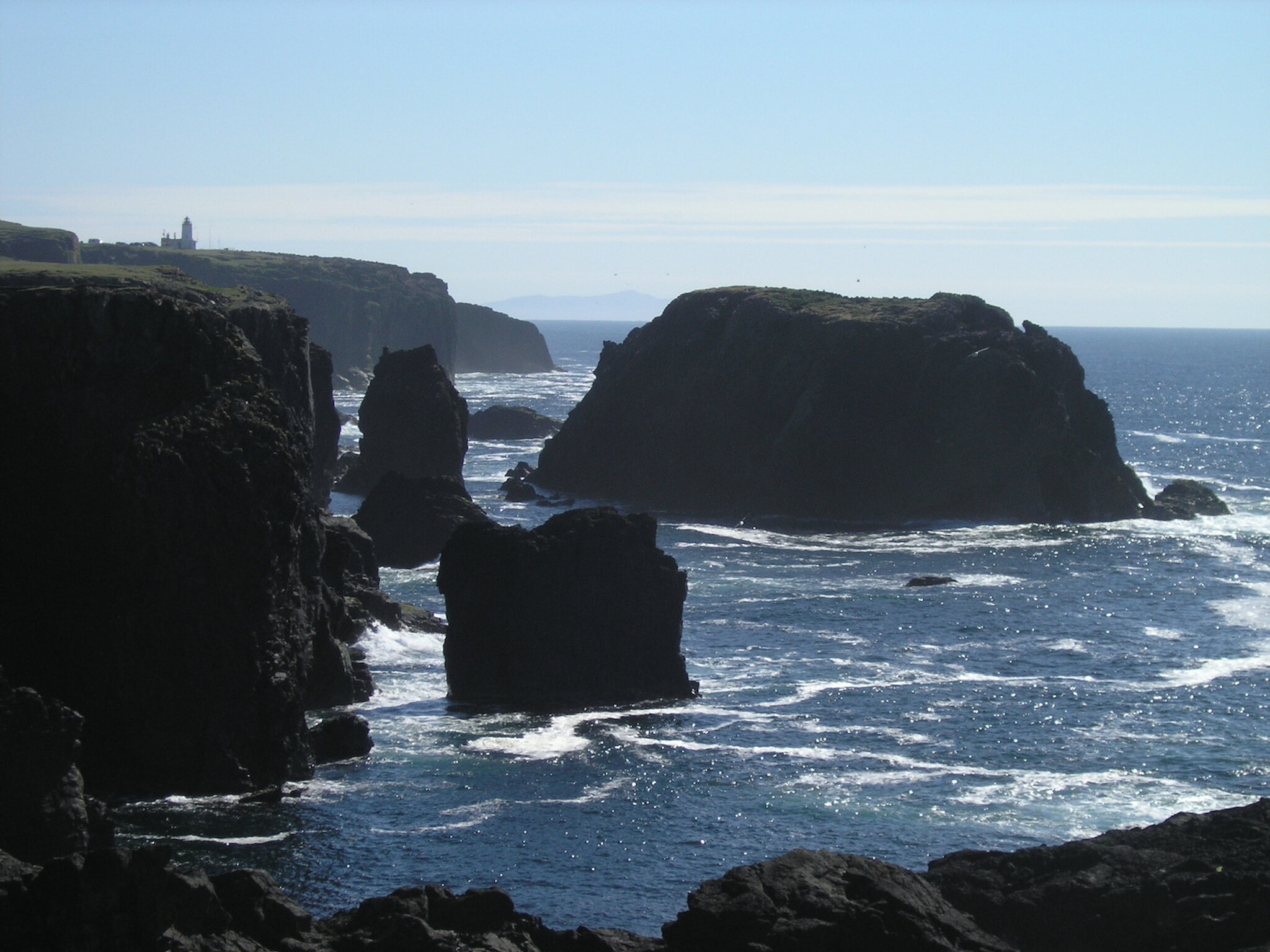
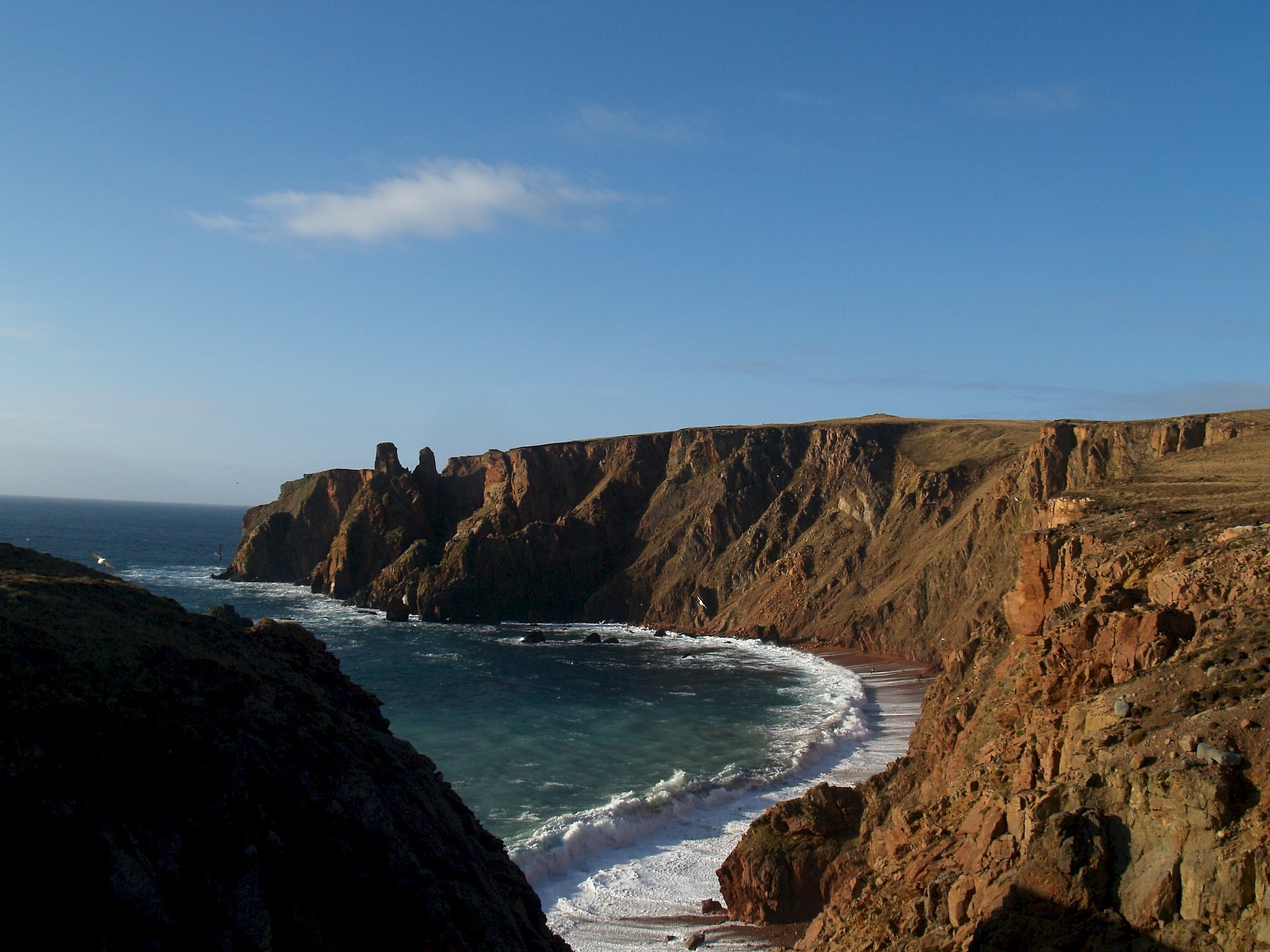
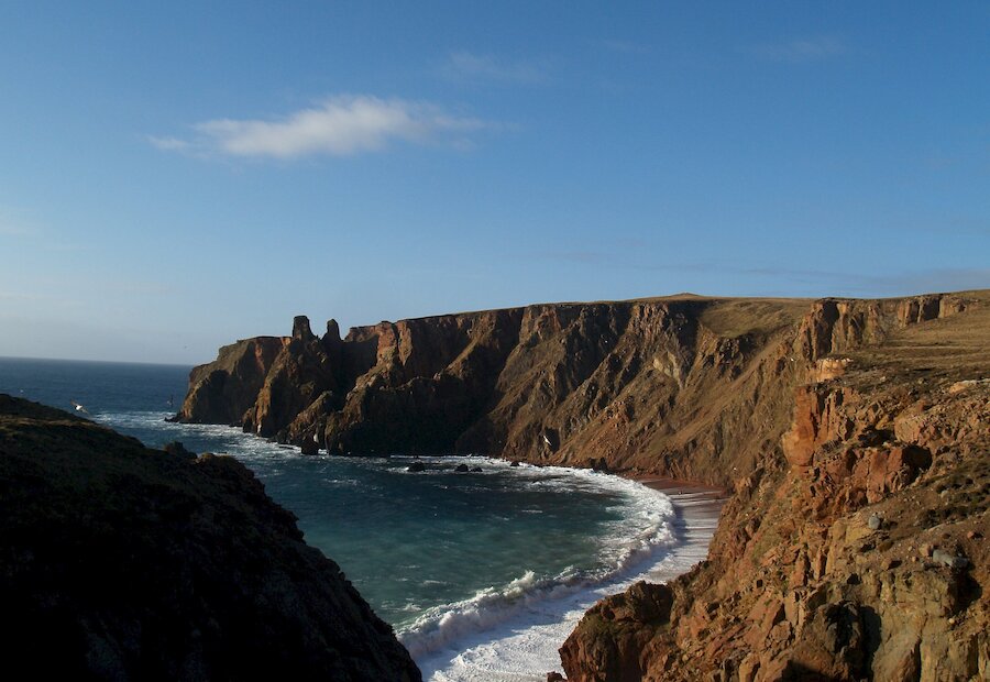
Just outside Hilswick take the B9078 to Eshaness. This road is a series of longish climbs and dips for the 3.5 miles (5.5km) to Braewick but is one of the most scenic stretches of road in Shetland. From the dip down to the dazzling bay of Sandwick each rise towards Braewick affords sweeping panoramas across St Magnus Bay to Papa Stour with the high peaks of Foula in the far distance. There are clear views from the hill above Zoar of the rock pillars in the cliff known as the Heads of Groken and of the iconic Drongs sea stacks just off the Ness of Hillswick. Topping Watch Hill and looking north-west there is an amazing view across Brae Wick and all over the expanse of the flat ground that makes up Esha Ness.

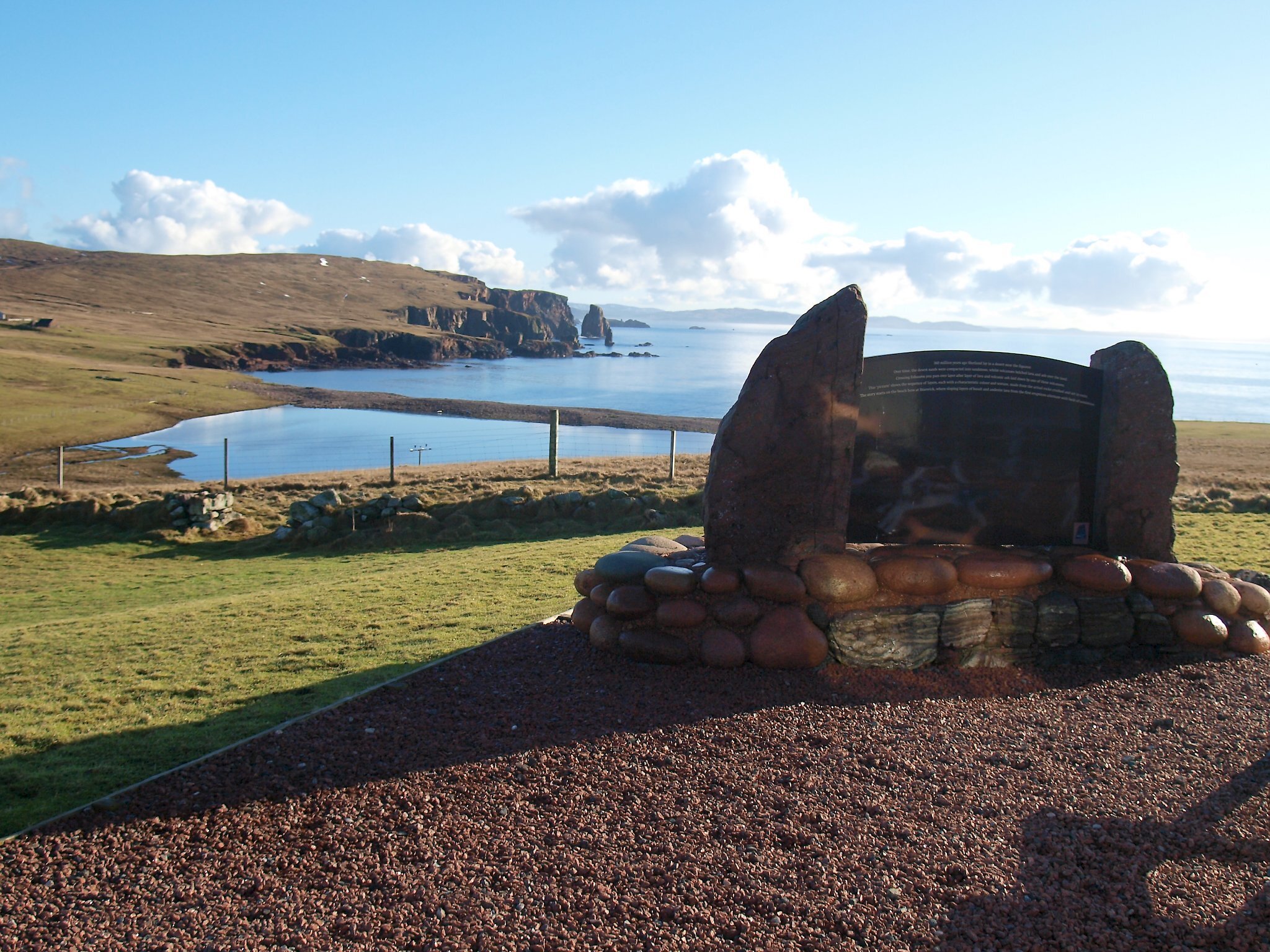
Esha Ness was once an active volcano some 390 million years ago and lavas and ash from this period make up the whole of Esha Ness. Geopark Shetland has produced a Volcano Trail guide to the area and this can be purchased at Braewick Cafe or downloaded from Geopark Shetland’s website.

Above the wide beach of red cobbles and boulders is the excellent Braewick Cafe, caravan park and campsite that also rents out ‘wigwam’ accommodation. Geopark Shetland has interpretive displays on the site where there is a sweeping panorama of St Magnus Bay and fabulous view south across the beach to the sheer red granite cliffs and the Drongs.

About 0.5 miles (0.75km) beyond Braewick turn left and take the ‘dead end’ road for for Tangwick and the excellent Tangwick Haa Museum. The Haa was built in the late 17th century for the Cheyne family, lairds of the Tangwick Estate, and is now a community museum and information point. All aspects of life in Northmavine over many years are illustrated in the displays at the museum.

Returning to the B9078 follow it 2 miles (3km) to the road end at Stenness, in doing so you have fine views of Dore Holm, Shetland’s ‘drinking horse’. This sheltered bay and wide beach of volcanic shingle in the otherwise wild coastline was the site of a ‘Haaf’ fishing station during the 19th Century. Geopark Shetland also has a display here explaining volcanic processes that formed the lavas of Esha Ness.

Returning from Stenness take the 1 mile (1.5km) of road to the left that ends at Esha Ness lighthouse and car park. From the cliff top beside the car park there is the most fantastic aspect of cliff scenery and sea stacks anywhere; these featured in the BBC TV series ‘Coast’. Nearby you can walk around to the long deep chasm of Calders Geo, surely Shetland’s ‘Grand Canyon’. From here there is an easy cliff top walk that will take you to such dramatic features as ‘da Hols o’ Scraada’ collapsed sea cave and the mind-blowing ‘Grind o’ da Navir’ gateway in the cliffs and its amazing rock amphitheatre surrounded by a storm beach of man-sized boulders. A headland on nearby Loch of Houlland boasts a good example of a ruined Iron Age Broch.

A description of all these features, and more, can be found in the Volcano Trail guide and there is a circular walk along the Esha Ness cliffs. Details are available on the Walk Shetland website: Eshaness Circular

Return to Hillswick by exploring some of the single-track side roads; the road end at Hamnavoe is the location of Johnnie Notions Böd; one of Shetland Amenity Trust’s network of camping böds (camping barns).

Search our cycle routes