Hermaness Hike

Walk Information

flagArea
Unst
hikingDifficulty Level
Challenging
info-circleRoute Distance
8 or 12km
clockDuration
3 to 5 hours
map-locationMap Description
OS Explorer 470: Shetland - Unst, Yell and Fetlar
locationStart Point Map Reference
HP 612 149
locationStart Point Map Reference (what3words)
///wedding.introduce.skirt
downloadGPX File
downloadKML File

Directions to start

Unst is accessible by inter-island ferry, and there is public transport available to the ferry terminal, through Yell to reach Unst, and through Unst itself; the bus timetables can be found on the Shetland Travel Information website.

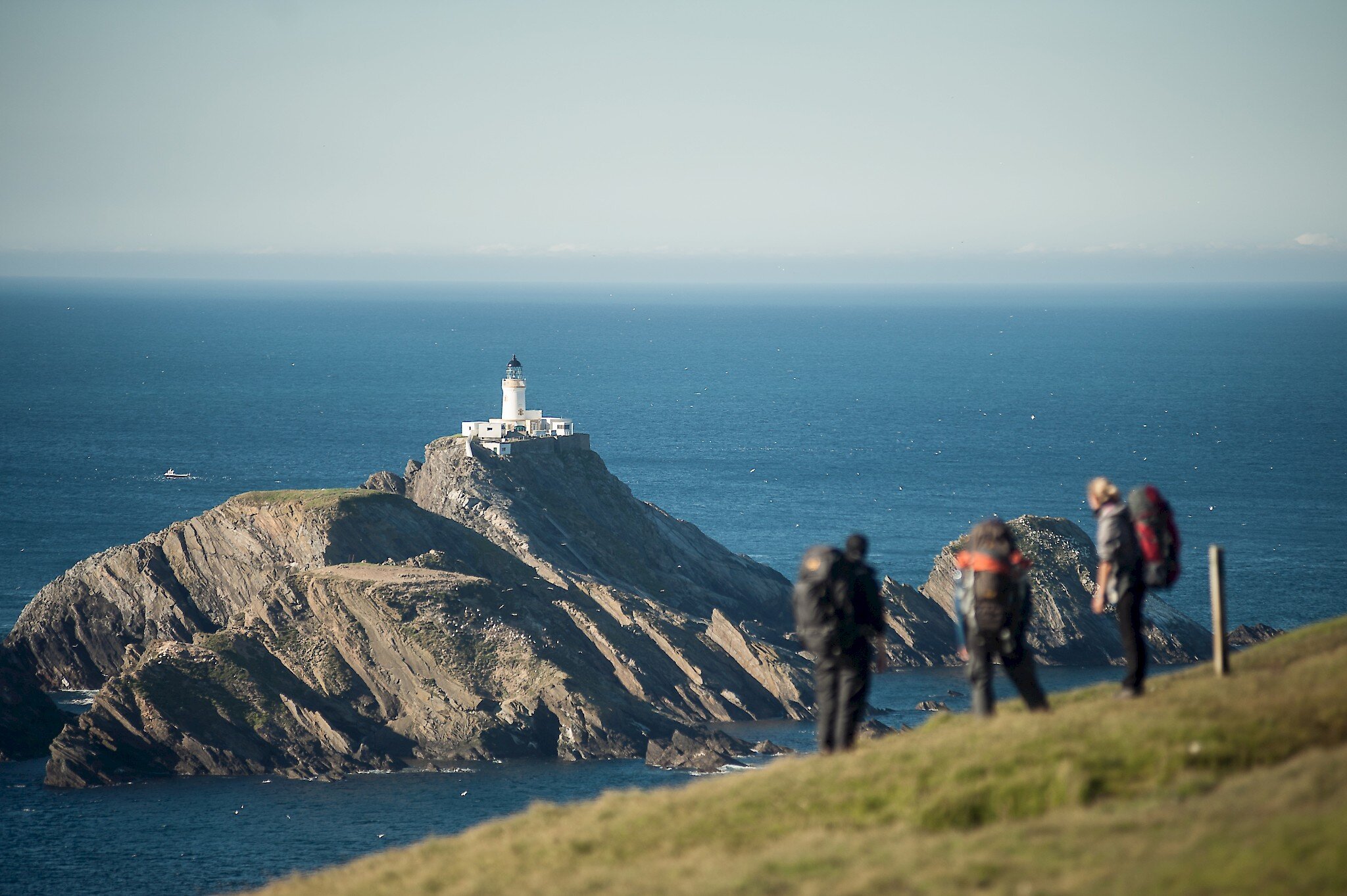
The return walk direct to Hermaness takes about three hours but can be extended south-west along the coast to Saito by ascending Neap; you should allow at least another hour for this.

The start point for the walk is the car park for Hermaness National Nature Reserve. New facilities were unveiled in May 2022 including a welcoming visitor hub with information points, toilets and improved car parking. The toilets are open daily from 1st May to 30th September. (Not suitable for disposal of campervan waste).

From the car park, follow the path north to Winnaswarta Dale, where a new recycled plastic boardwalk leads you across the reserve to the western cliffs. The path was installed in spring 2022 and is designed to preserve the fragile blanket bog vegetation and is routed to avoid nesting birds and other wildlife.

The blanket bog records over 7,000 years of vegetation history at Hermaness and provides nesting habitat for Red-throated Diver, Snipe, Dunlin and Golden Plover. In summer Shetland’s annual ‘pirate’ visitor, the Bonxie (Great Skua), favours this reserve with almost 1000 pairs nesting here. Bonxies breed from May to August before migrating south in the winter some perhaps as far as West Africa.

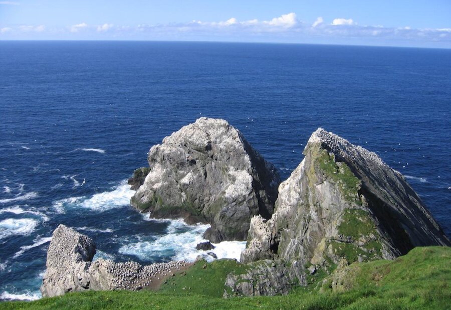
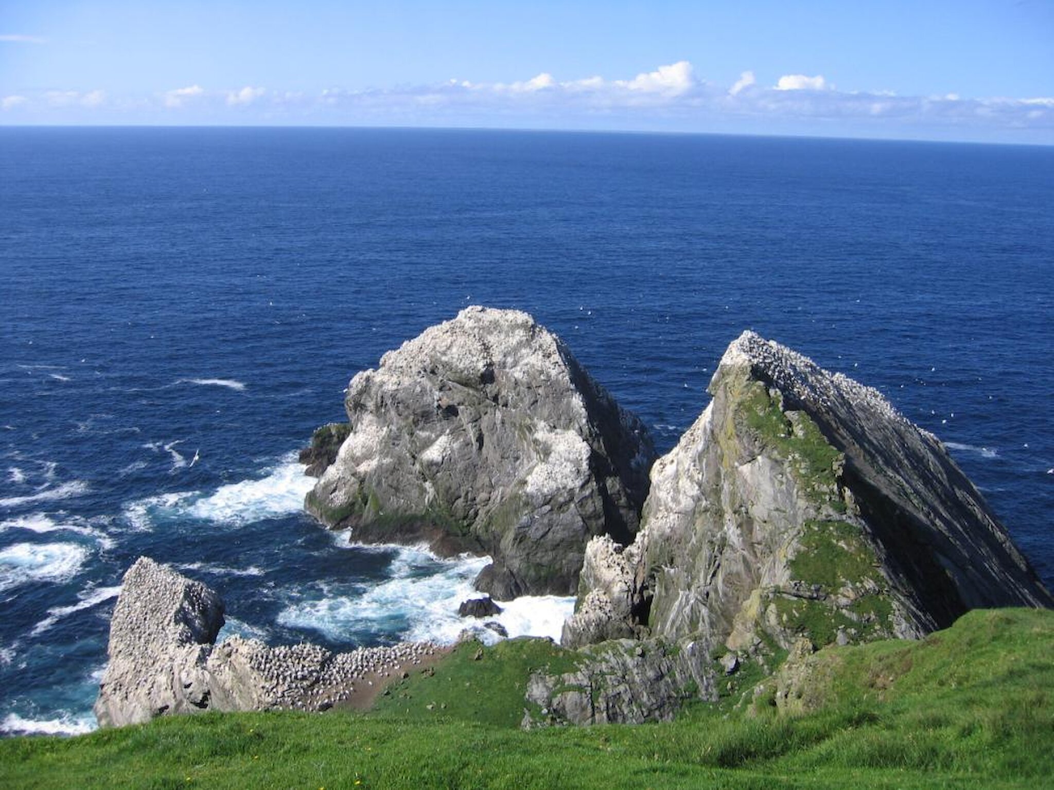
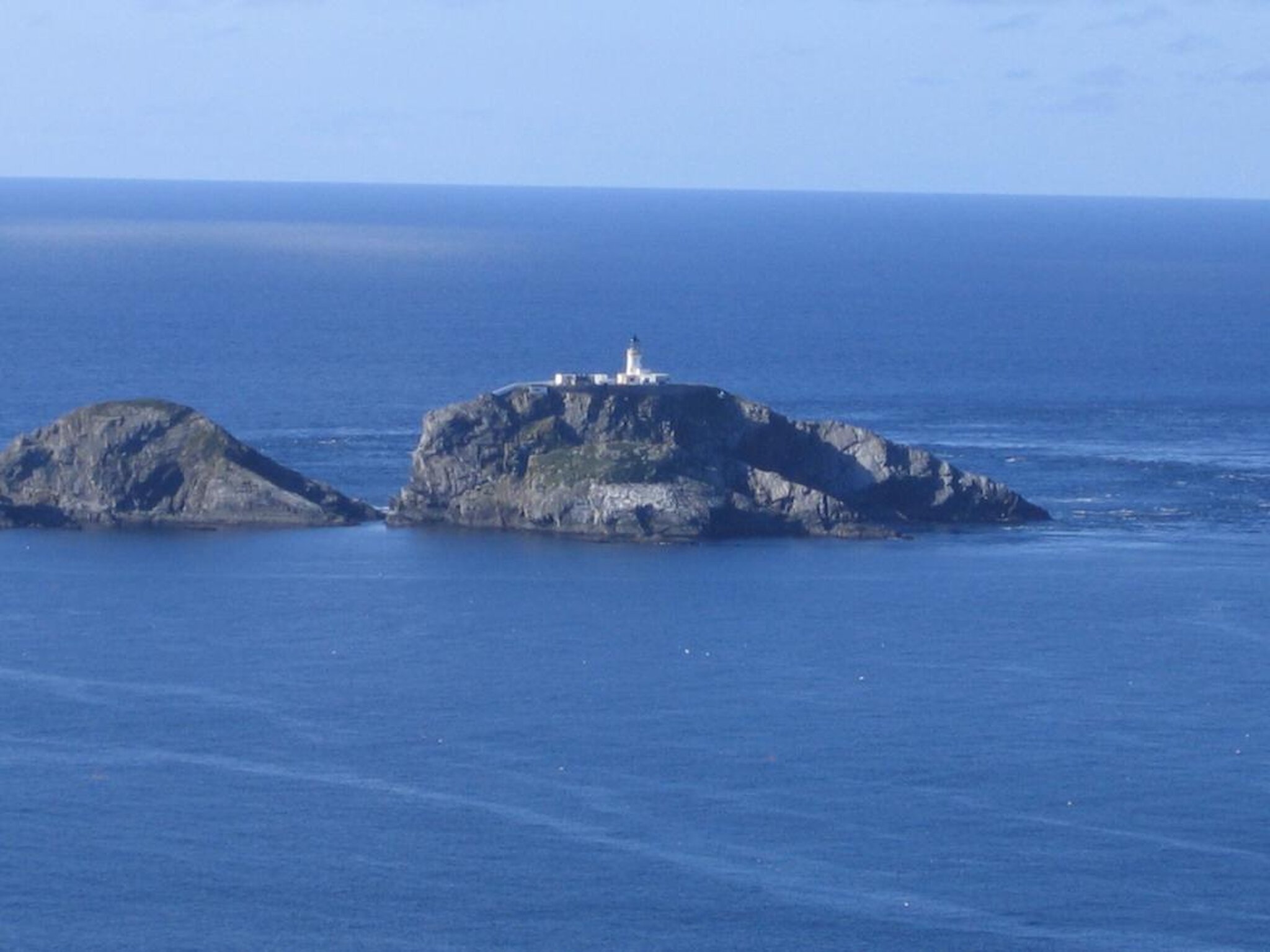
The path reaches the cliff top at Toolie, offering spectacular views of the rugged coastal landscape and the vastness of the Atlantic Ocean. From here you may wish to take a detour to the south as far as Saito and experience the sight (and smell) of the gannet colony on the 170 metre (600 foot) cliffs of the Neap. Over 25,000 pairs of gannets, Britain’s largest seabird, return to Hermaness each year to lay their single eggs in nests built of seaweed cemented with guano. The cliffs also reveal some of Hermaness’ spectacular geology with contorted veins of pink granite weaving through grey gneiss, formed 600 million years ago as a result of intense heat and pressure on what were once quartz rich sands.

Turning northwards at Toolie, the path drops steeply into Sothers Dale, past a stone sheep pen whose name – Setter House – hints at past human habitation. The cliffs and grassy slopes along the route are dotted with puffin burrows and fulmar nests, whilst smartly dressed black and white guillemots line the ledges close to sea level where they lay their eggs directly onto the rock. Following the coast, a group of offshore rocks known as ‘Da Waithing Skerries’ slowly comes into view. Most prominent is Muckle Flugga (large steep rock) with its lighthouse breathtakingly perched on top. Designed by Thomas Stevenson and built of brick, the lighthouse has withstood pounding by Atlantic storms for over 150 years. Beyond this is Da Shuggi or Out Stack: the most northerly extremity of the British Isles.

At the north-west corner of the headland are several stacks covered with gannet nests, and from here a path leads up Hermaness Hill to the ruins of a hut. This was the old signal station for Muckle Flugga Lighthouse - in the days before radio, semaphore messages would be sent from here to the lighthouse. If you choose to pay a visit, please don’t go beyond the hut as the hilltop is a sensitive nesting site for red-throated divers.

The route continues past the Taing of Looswick, where a narrow band of lime rich rocks gives rise to rich grassland very different from the moorland and bog that covers most of Hermaness. The end point of the walk is the small headland between Boelie and Wilna Geo – Britain’s most northerly accessible point and the closest spot to Muckle Flugga. Few people have set foot beyond here. One who did was Lady Jane Franklin who in 1849 visited Out Stack to offer prayers for her missing husband, Sir John Franklin, leader of the ill-fated expedition to find the North-west passage.

You can find out more about Hermaness Nature Reserve from the Nature Scot website.

Find your next walking route