With the long daylight hours, it is still one of the best times to discover the islands and in particular the rich array of complementary natural heritage and human history that frequently may be encountered a matter of yards from the front door. Garths Croft owner Chris Dyer sets out to walk the Bressay coastline adjacent to the National Nature Reserve of Noss.
July is a busy month on the croft as hay and silage crops are taken, sheep shearing continues and early soft fruit and vegetables are harvested. Conservation fields subject to an absence or minimal grazing are replete with a variety of brilliantly coloured wildflowers, including spectacular orchids.
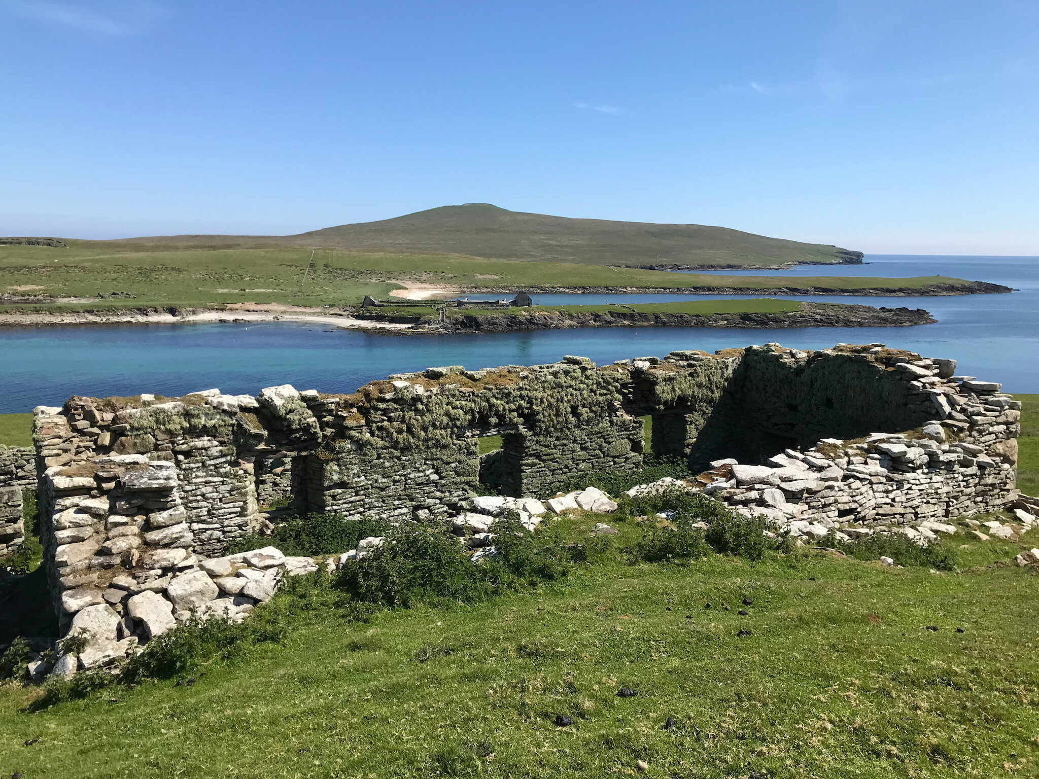
The view from Southerhouse looking south-east towards the North Sea. Photo: Chris Dyer.
From east to west
The birth of Lerwick in the seventeenth century and its expansion to become the capital of Shetland had a profound impact upon the island of Bressay.
Over subsequent centuries, the population distribution of the island evolved to reflect and interact with the new economic centre.
Today, the majority of inhabitants look west to Lerwick with settlement predominantly flanking and overlooking the shores of Bressay Sound.
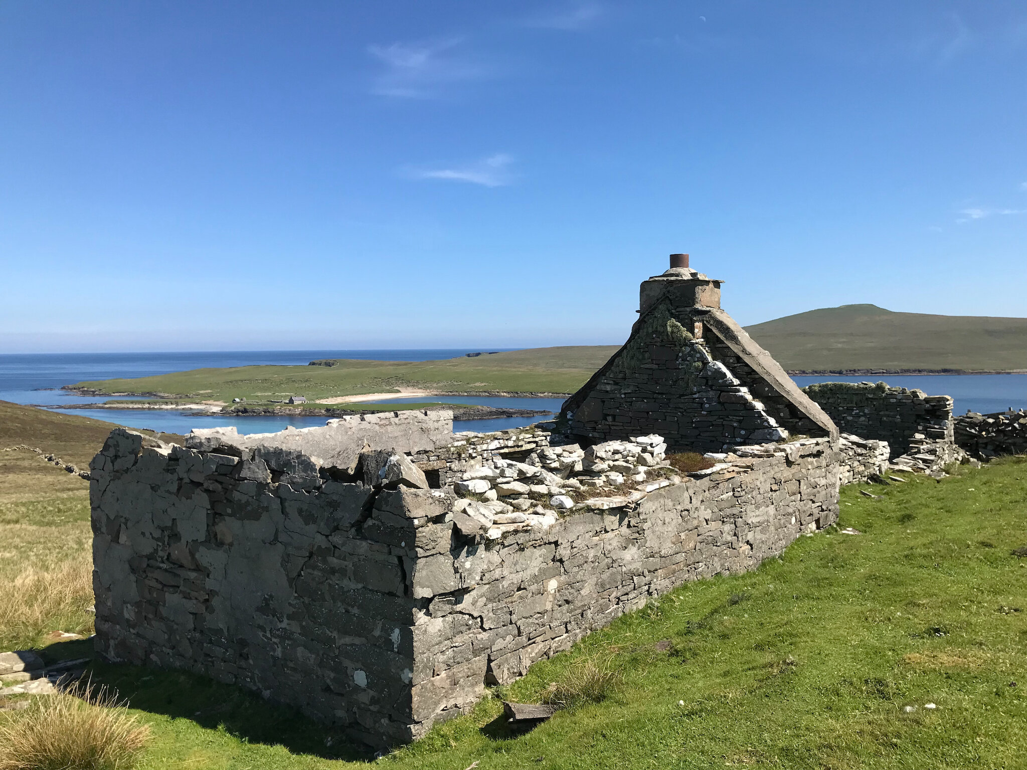
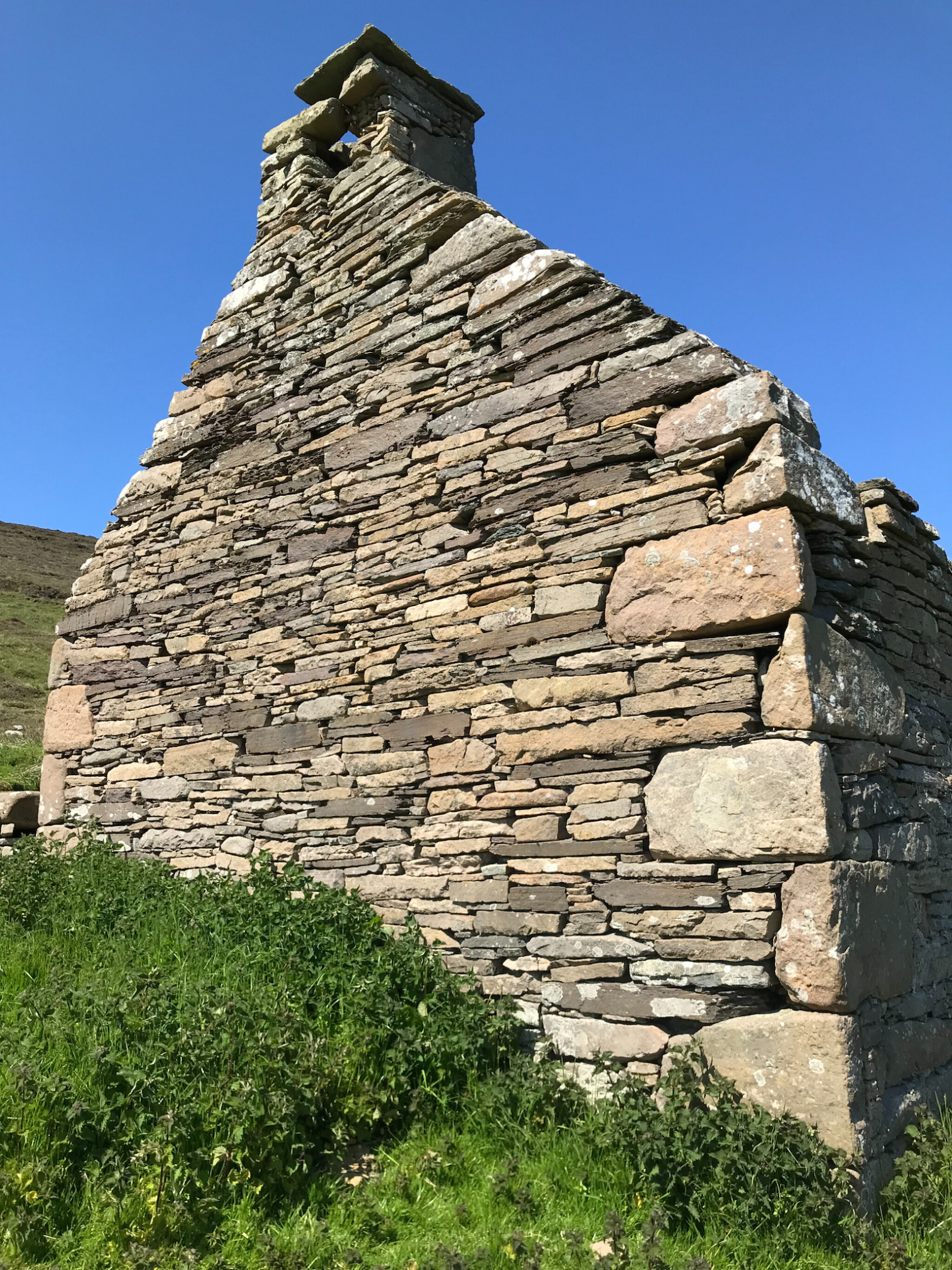
What's left of Northerhouse, also known as 'The Ferryman's House', looking across to Noss and its national nature reserve. Photo: Chris Dyer.
This stretch of water has long been of significance with the Icelandic Saga of Haakon Haakonarson first recording what appears to be Bressay Sound when King Hákon of Norway rendezvoused with his war fleet in 1263 in ‘Breiðeyjarsund’.
From the mid fifteenth century, Hanseatic merchants traded in Shetland waters whilst by the mid seventeenth century, Dutch vessels would arrive and wait in Bressay Sound before the commencement of herring fishing at Johnsmas on 24 June.
The vessels of many nations continued to visit Bressay Sound to shelter, fish and trade. Greenland whalers, German battleships and eastern European Klondykers have been drawn by the magnetic pull of Lerwick Harbour, as has the island of Bressay.
The arrival of the Vikings fundamentally influenced the cultural evolution of Shetland.
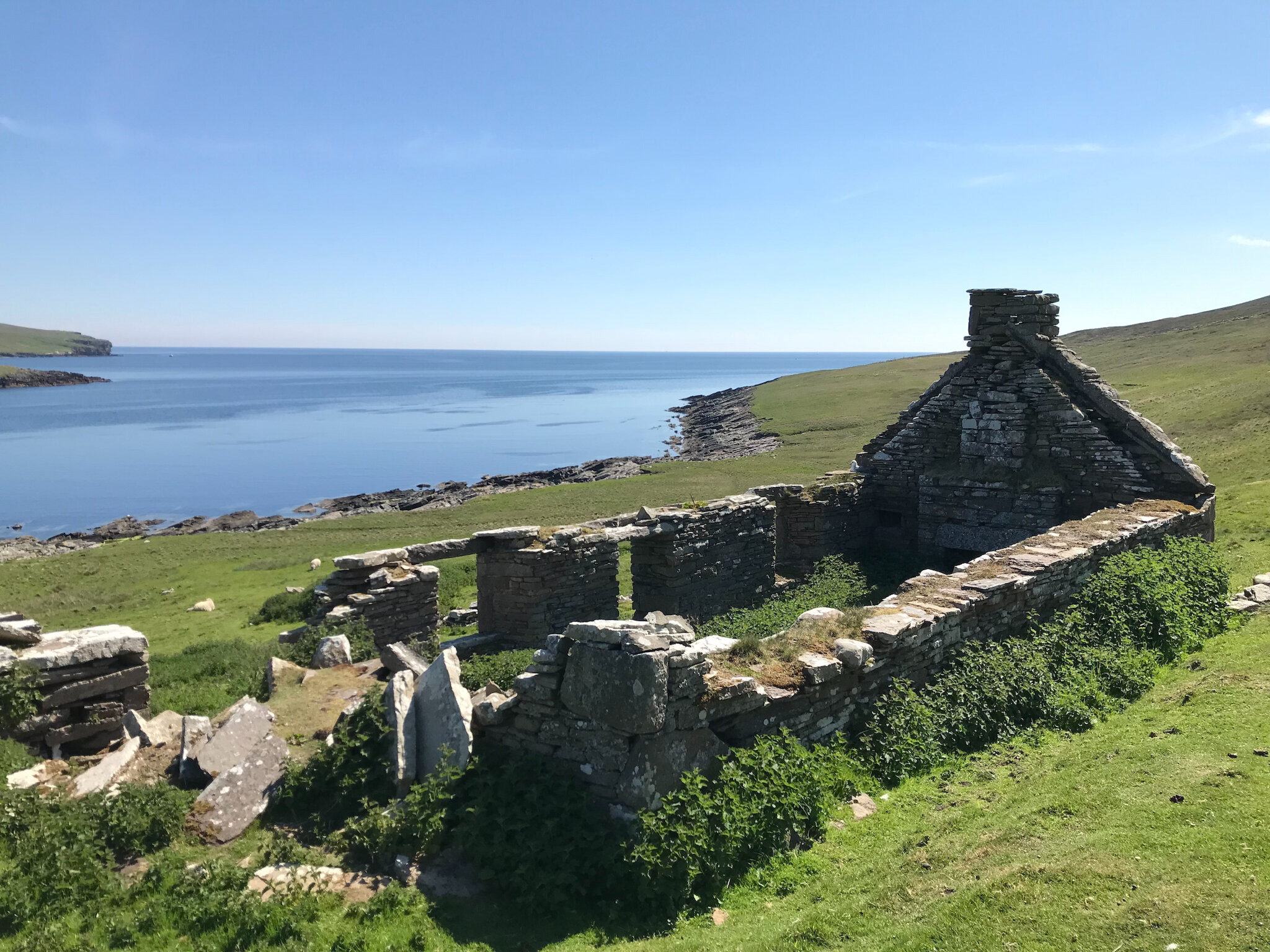
On its formerly populous east side, there are many deserted crofthouses and even whole deserted settlements such as Wadbister, Grimsetter, Aith and Cullingsbrough. The crofts of Noss Sound represent one such community. Longevity of settlement.
The island of Noss lies to the east of Bressay and is separated by a stretch of water known as Noss Sound. The Mouats of Garth acquired Noss in the 1670s and it has remained part of the Garth Estate ever since.
The population may never have been large although there were 24 people living on the island in the mid-nineteenth century. The last resident family left in 1939 and from then until 1969, a shepherd and family stayed on the island during the summer.
Noss became widely known through the writings of visiting naturalists, travellers and artists and became a National Nature Reserve in 1955. Today seasonal reserve staff are employed by Nature Scot to provide guidance and information to visitors and to monitor the population size and breeding success of the seabirds, flora and fauna.
Noss and the adjacent Bressay coastline retain sites and monuments within the landscape testifying a significant longevity of settlement over millennia. Neolithic or Bronze Age structures on Noss at Cols Ness and Voe o’ da Mels, as well as a burnt mound at Helia Cluve, reflect a density of prehistoric occupation.
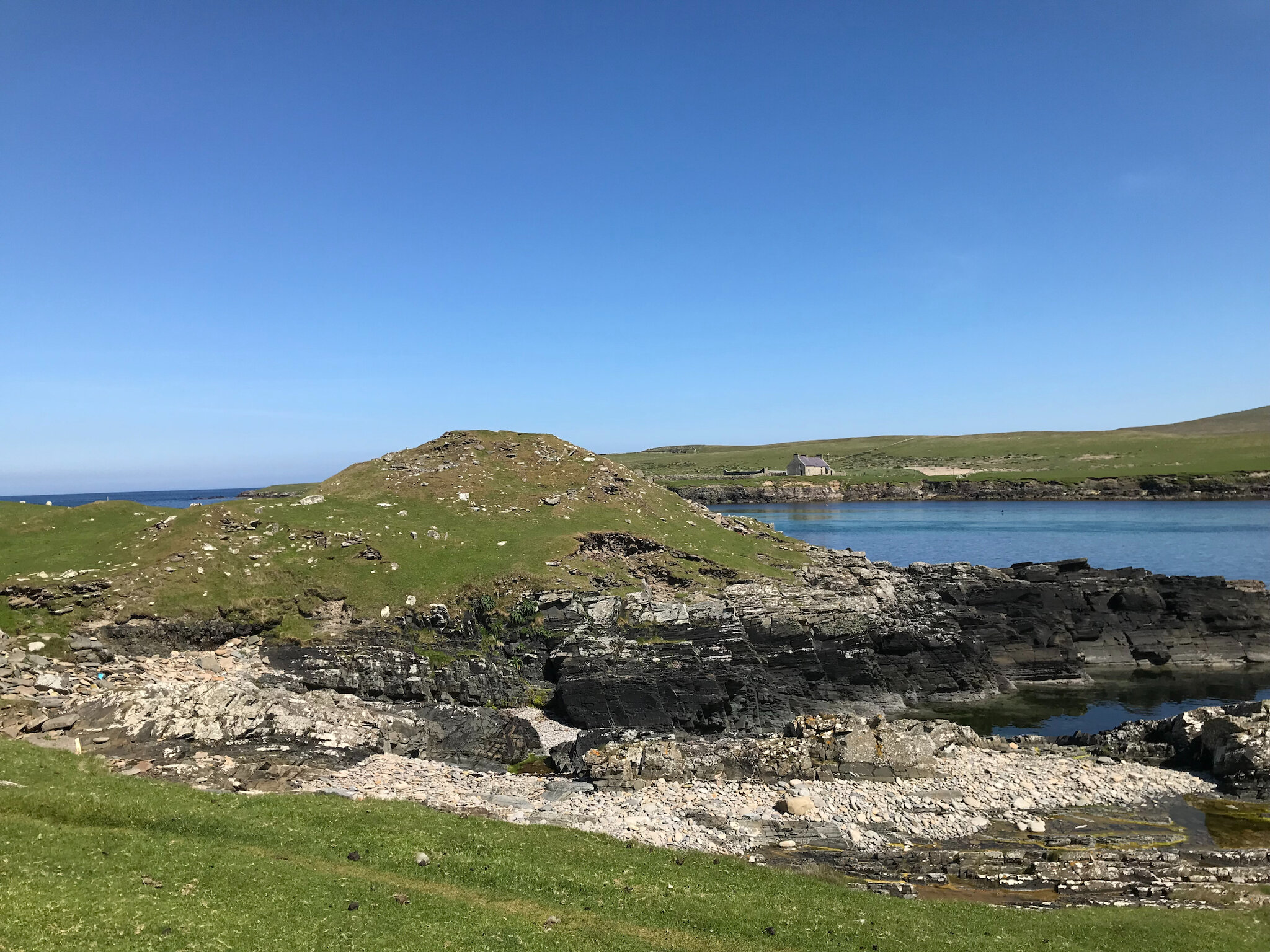
To the west, on the Bressay shoreline at Burgi Geo is the dominant presence of an Iron Age broch which is represented by a mound almost five metres in height with wall coursing clearly visible. Four other broch sites are recorded in Bressay at Aith, Heogan, Cullingsbrough and Brough.
Visiting the site at Noss Sound in 1822, Samuel Hibbert noted cells within the walls although these are less discernible today. The promontory on which the broch is situated is isolated from the mainland by two massive banks of earth and stone, akin to a defensive rampart.
Noss Sound would have been able to support agriculture with the marine resource so close at hand. However, as the Shetland population reached its peak of 31,670, the situation was not to last.
By the sixth century AD, a pagan but sophisticated Pictish culture was influenced by the arrival of Christianity. An early chapel site is located in Noss, immediately to the south of Gungstie.
The chapel was extant in 1711 when Sibbald reported that it was built by “shipwrakt persons, the time and the name of it is not known”. Henry Dryden planned the nave and chancel in 1852, by which time only a fragment of the north wall stood aboveground.
The arrival of the Vikings fundamentally influenced the cultural evolution of Shetland and is evidenced by the name the Vikings gave to Papil (priest) Geo, a short distance to the north of the chapel site.
Furthermore, a possible Viking or later Norse structure has been identified at Southerhouse, on the Bressay coastline, a sub-rectangular earthwork projecting beyond the foundations of the derelict croft house.
Beautiful stonework in the gable end of Southerhouse. Photo: Chris Dyer.
The 18th and 19th centuries
Noss was described by Sibbald in 1711 as “stored with bestial and there is considerable corn land”. In 1774, George Low similarly describes the well cultivated lands with “crops more forward than in other areas of Shetland”.
Indeed, in the 1792 Statistical Account of the United Parishes of Bressay, Burra and Quarff it is deemed “one of the finest and most fertile in Shetland”.
Noss Sound would have been able to support agriculture with the marine resource so close at hand. However, as the Shetland population reached its peak of 31,670, as recorded in the 1861 census, the situation was not to last.
By the second half of the nineteenth century, a large population was crammed into every available parcel of land, much of it marginal.
The tumultuous intervention of estate factors in the late nineteenth century, tasked with rationalising lands and creating larger, more viable units and the expansion of sheep farming, led to a significant number of subsistence agriculture townships emptying.
Whilst Noss continued to be inhabited into the twentieth century, the character of this landscape had fundamentally changed.
Today the crofthouses lie empty although their walls, hearths, dykes, crubs, field systems, cultivation rigs, clearance cairns and pathways survive and tell the story of generations of people who called this home.