• Home
  • Blog
  • A crofter's diary: History on my doorstep
By Chris DyerNovember 1st 2021

As the clocks go back, Garths Croft Bressay owner Chris Dyer makes the most of shortening daylight hours and explores the landscape of his historical neighbours closer to home.

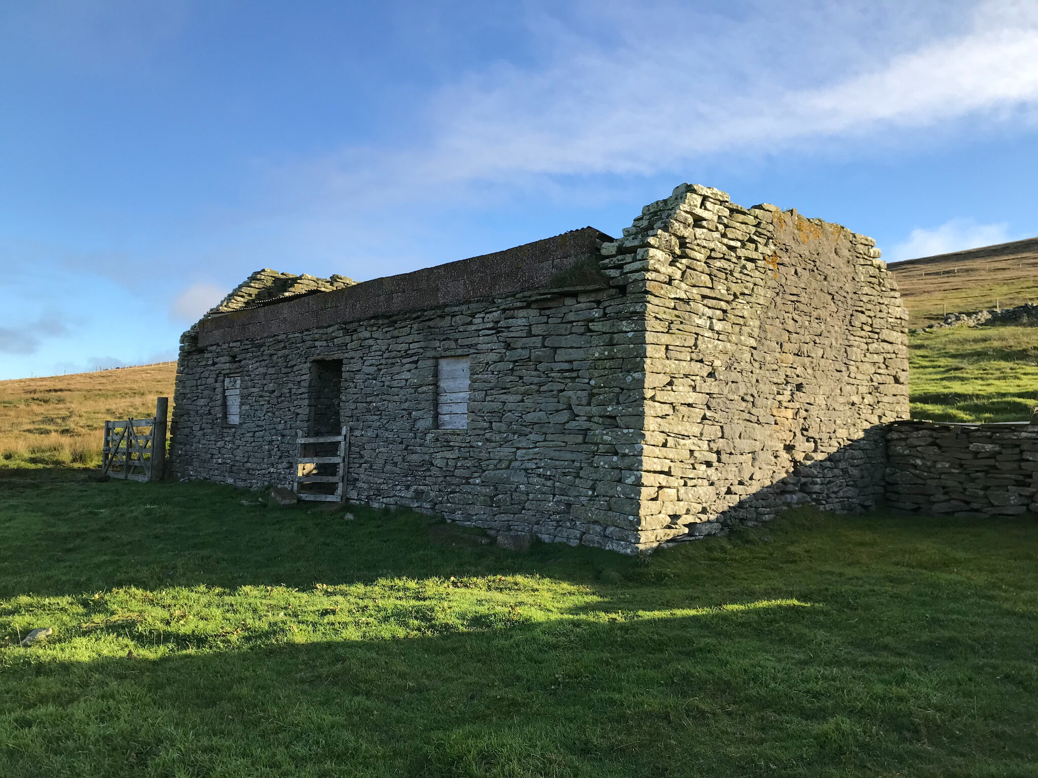
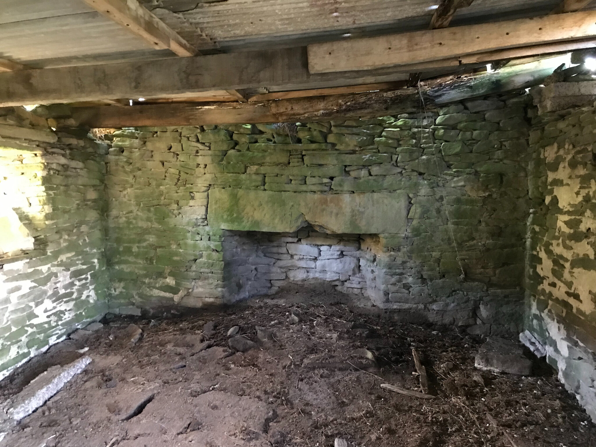
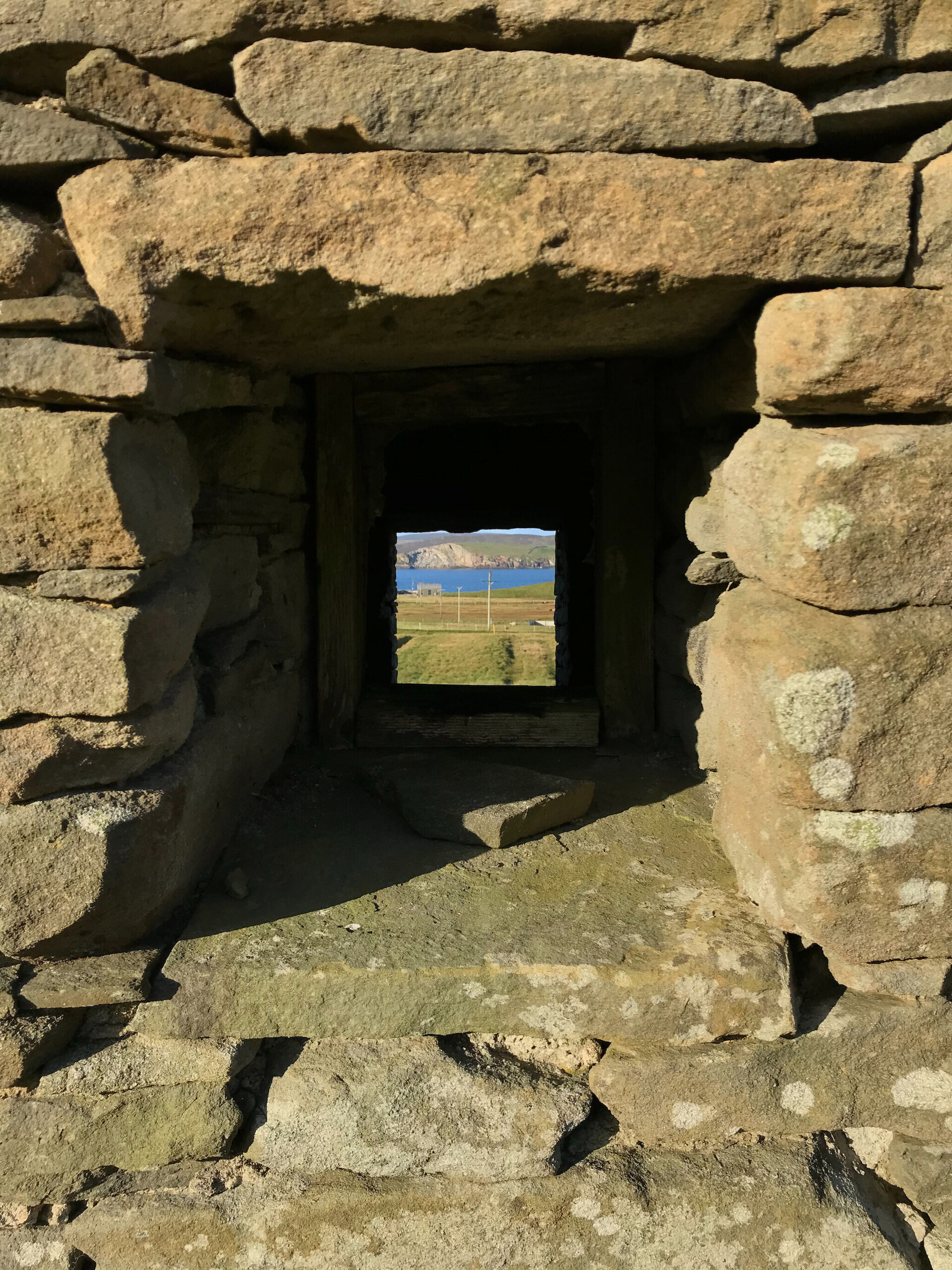
For Shetland residents today, the prospect of an additional 10,000 people within a population of approximately 23,000 requires a degree of imagination. And yet one of the most frequently noted aspects of the Shetland landscape, especially by the visitor, is the number of abandoned 19th and early 20th century dwellinghouses and outbuildings. Some may be replete with items of everyday life, indisputably a home with which to look at and empathise; an in situ rayburn, window glass, crockery and wallpaper, while others consist of merely masonry wall lines, useful artefacts such as roof timbers long since having been recycled or recommissioned.

The 1861 census recorded almost 32,000 island residents, significant and sizeable during the era of subsistence agriculture and a reliance upon the sea for both employment and sustenance. Given the expanses of hill and peat moorland juxtaposed with smaller pockets of often coastal cultivatable areas, from a historical perspective Shetland was always marginal and finely-balanced for supporting an increasing population. It is understandable therefore, albeit tinged with melancholy, how a move towards aggregated holdings capable of supporting large agricultural units, specifically sheep farms with imported commercial breeds, was synonymous to an extent with population decline as emigration took Shetlanders truly across the world.

Eyes on Anntown

At Garths Croft Bressay, the daily rituals of feeding and maintenance through all weathers (and all wardrobes!) are overlooked by the ruinous croft house of Anntown which is situated uphill, independently within about 10 acres of grazing ground. Anntown is an enigma; to start with it is an ‘ootset’, constructed outwith the hill dyke that traditionally separated the improved, cultivated in-bye ground from the hill. These fundamentally important sinuous structures snake the length and breadth of Shetland, demarcating through drystone walls a boundary within which crops could be grown and sheep excluded during the summer months. But, as noted above, during the second half of the 19th century, such was the population pressure, new croft houses were constructed on ground hitherto excluded as unviable.

Outsets invariably therefore imply a degree of hardship and desperation, manifesting themselves as often short-lived attempts to continue the traditional way of life in a rapidly changing world. Indeed, an unrelated outset on the east side of the island of Bressay, adjacent to the National Nature Reserve of Noss, is named ‘Houllmastouri’, etymologically-interpreted from the Old Norse for ‘Big Hill’. The clue to the struggles here indeed lies in the name!

Mapping the islands

Anntown is not depicted on the First Edition 1878 mapping of the Shetland Islands, part of an epic and historically fascinating undertaking to map the United Kingdom born of political revolution, rebellion and social upheaval that resulted in the creation of the now ubiquitous Ordnance Survey. The vestiges of this scientific cartography almost 150 years ago can sometimes be glimpsed today in Shetland through a brass stud set into a bedrock face, used as part of the initial military programme of triangulation to calculate elevation and contours.

By the early 20th century Second Edition mapping, the croft house of Anntown had emerged, carved out of the hill with linear boundaries on three sides reflecting the use of fencing wire. Walking the ground on a daily basis, looking west across to the Ness of Sound, the South Mainland and watching the NorthLink ferry depart and arrive, it's apparent that linear rigs, bridges and drainage have been created to enable arable crops, specifically oats or barley, to be grown. An unroofed outbuilding immediately adjacent to the house is indisputably a byre where cattle would have been stalled in winter months whilst the drystone yard to the east, uphill behind the house, is where hay may have been stacked and kale cultivated from seedlings established in the nearby planticrub. Fresh drinking water would have been sourced from a well, also noted on the early mapping. Inside the house, the original flagstone floor is still in place, admittedly below many generations of midden material as sheep flocked and sheltered from westerly winds. Two enormous sandstone lintels sit atop the open fireplaces at either end of the house and one wonders how many people were involved in the attempt to lift them into place or indeed when the chimneys finally stopped smoking.

Stories of smuggling

Although Anntown was a short-lived occupation and derelict by the early twentieth century, we know through the excellent work of the Shetland Family History Society and North Isles Family History that Ella Jane Drummond Hunter was born at the croft in 1911. Additionally, late nineteenth century resident John Gifford was a crewman aboard the Seabird, part of the small-scale herring fishery that was carried out from Ham, Bressay, where boats sailed to the grounds south-east of the Bard headland. Related research by Bressay History Group tells of illicit smuggling aboard the Seabird whereby, on one occasion, the crew had obtained several earthenware ‘pigs’ of gin and a quantity of tobacco, in exchange for eggs and Bressay new tatties. John Gifford of Anntown was landed at the mouth of the Veng burn and transported the cargo by hand over the Blackhill, temporarily concealed in his peat bank, thus avoiding customs levies from any suspicious harbour officials!

The Shetland landscape is a tapestry; a canvas of thousands of years of human history and occupation preserved within the landscape to be deciphered, explored and enjoyed. I am fortunate to graze the fields around the croft house of Anntown with my colourful Shetland sheep and, who knows, one day it would be a rather fine restoration project, wouldn’t it?