• Home
  • Blog
  • Part Two: The West & North Mainland
By Alastair HamiltonFebruary 23rd 2017
Alastair Hamilton

As I explained in the first part of this blog, last month, Shetland is larger than most people imagine. Our NAFC Marine Centre recently overlaid Shetland on a map of south-east England, demonstrating that if you travel from Unst to Fair Isle, you’ll have covered the distance from Cambridge to a point just a couple of miles north of Chichester. If you’re in Scotland, the equivalent is from Forfar to Moffat or (from east to west) from Leuchars to Cumbernauld.

So, even with our good roads and frequent ferries, you’ll need at least a week and ideally two if you really want to see and begin to understand the islands.

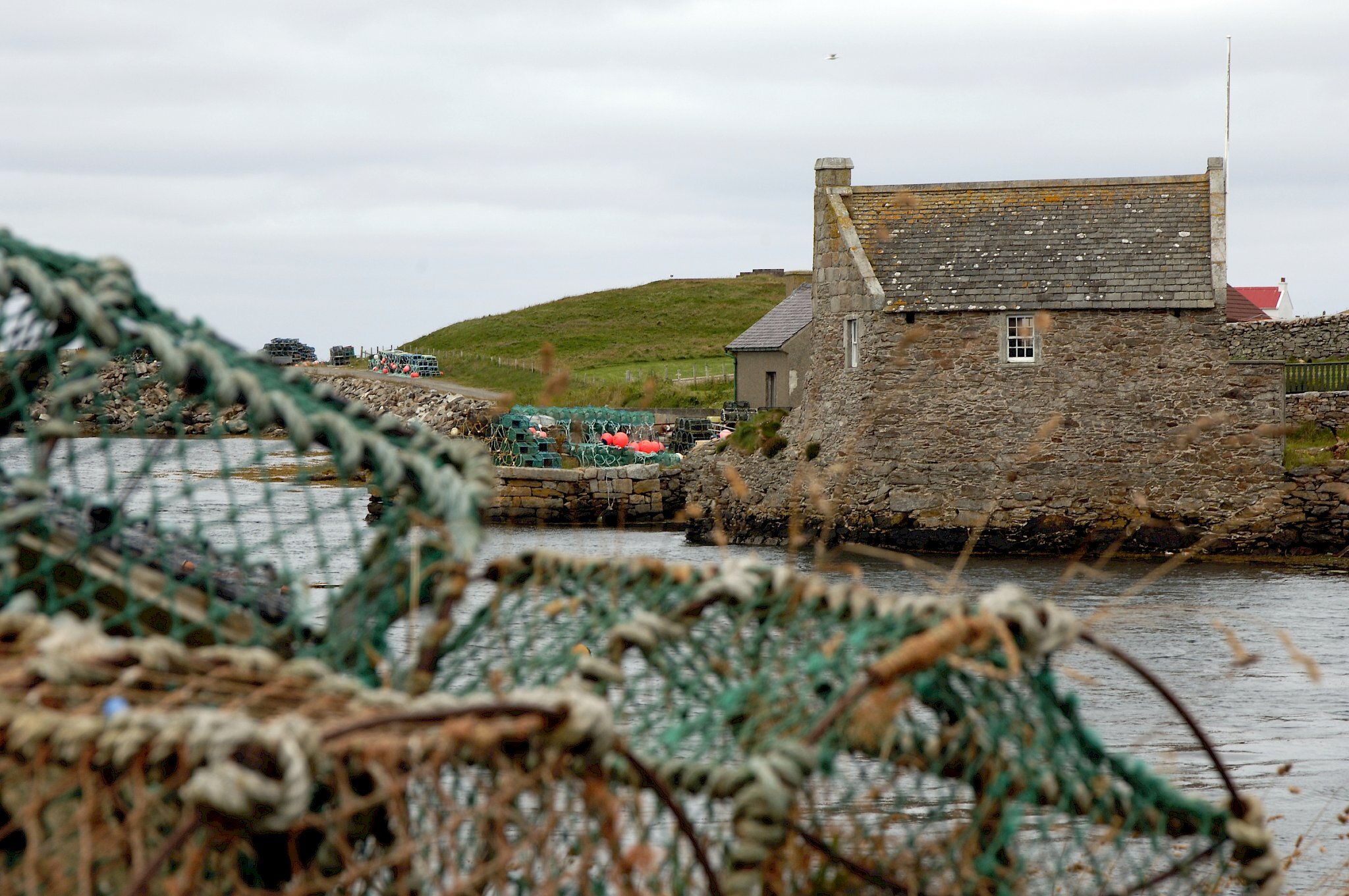
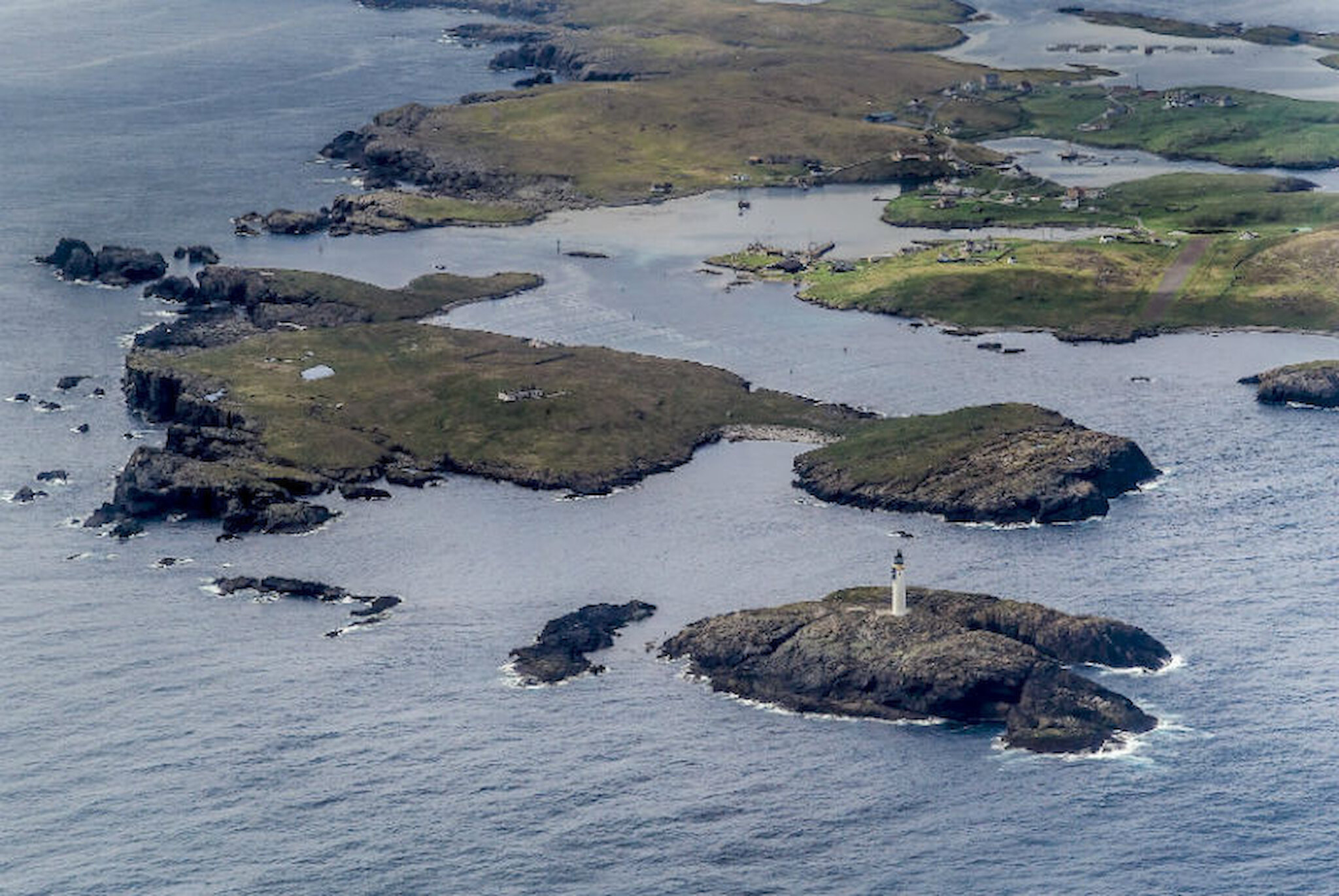
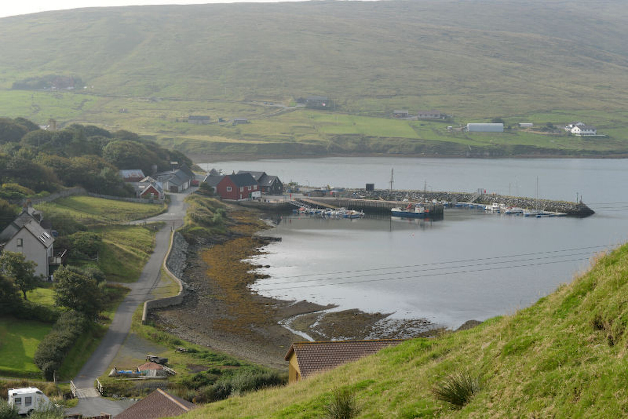
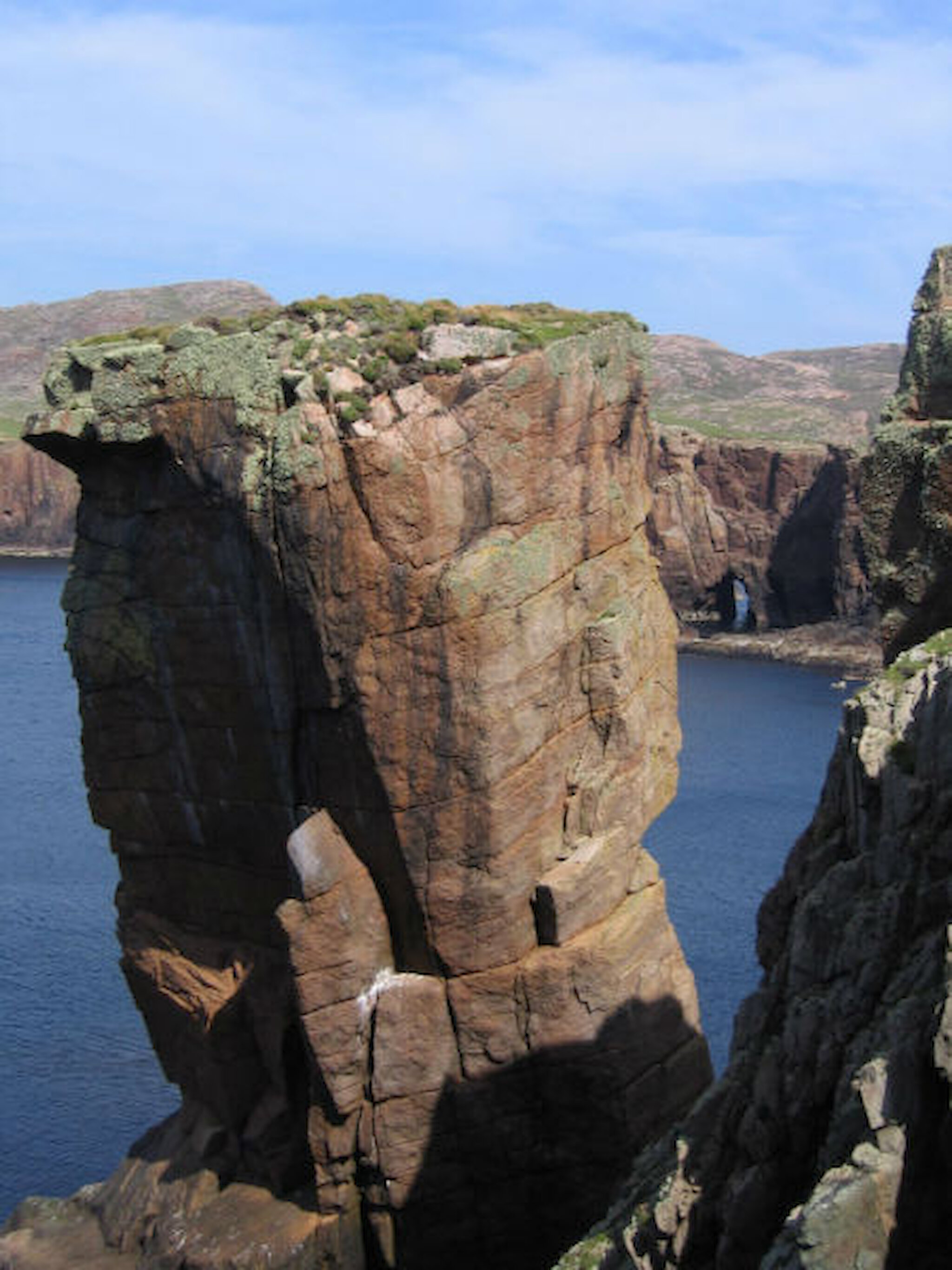
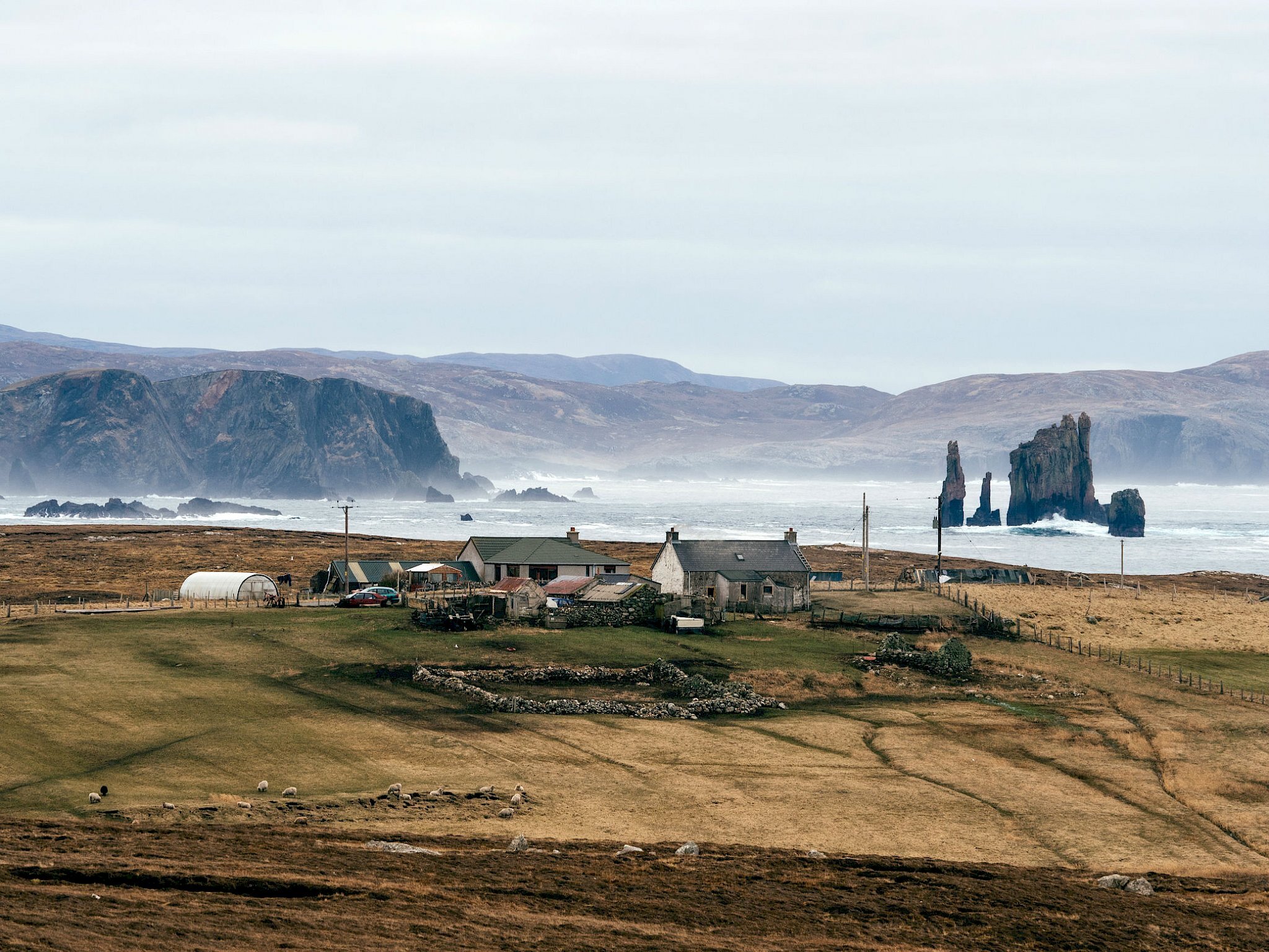
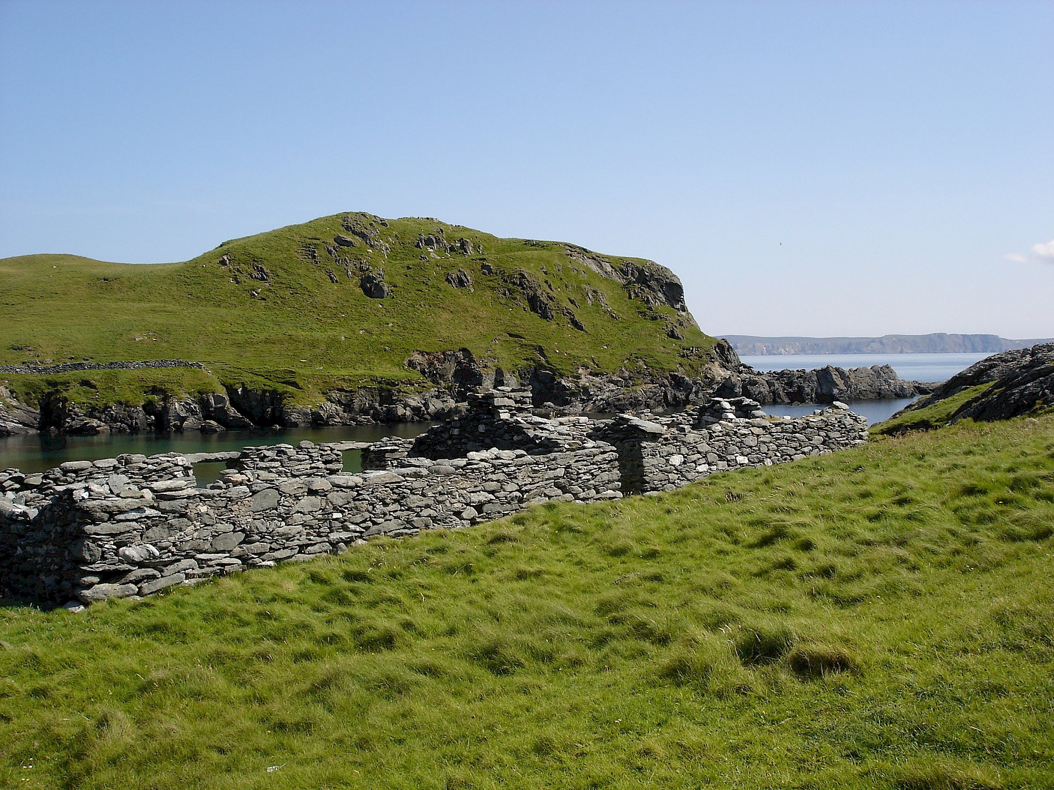
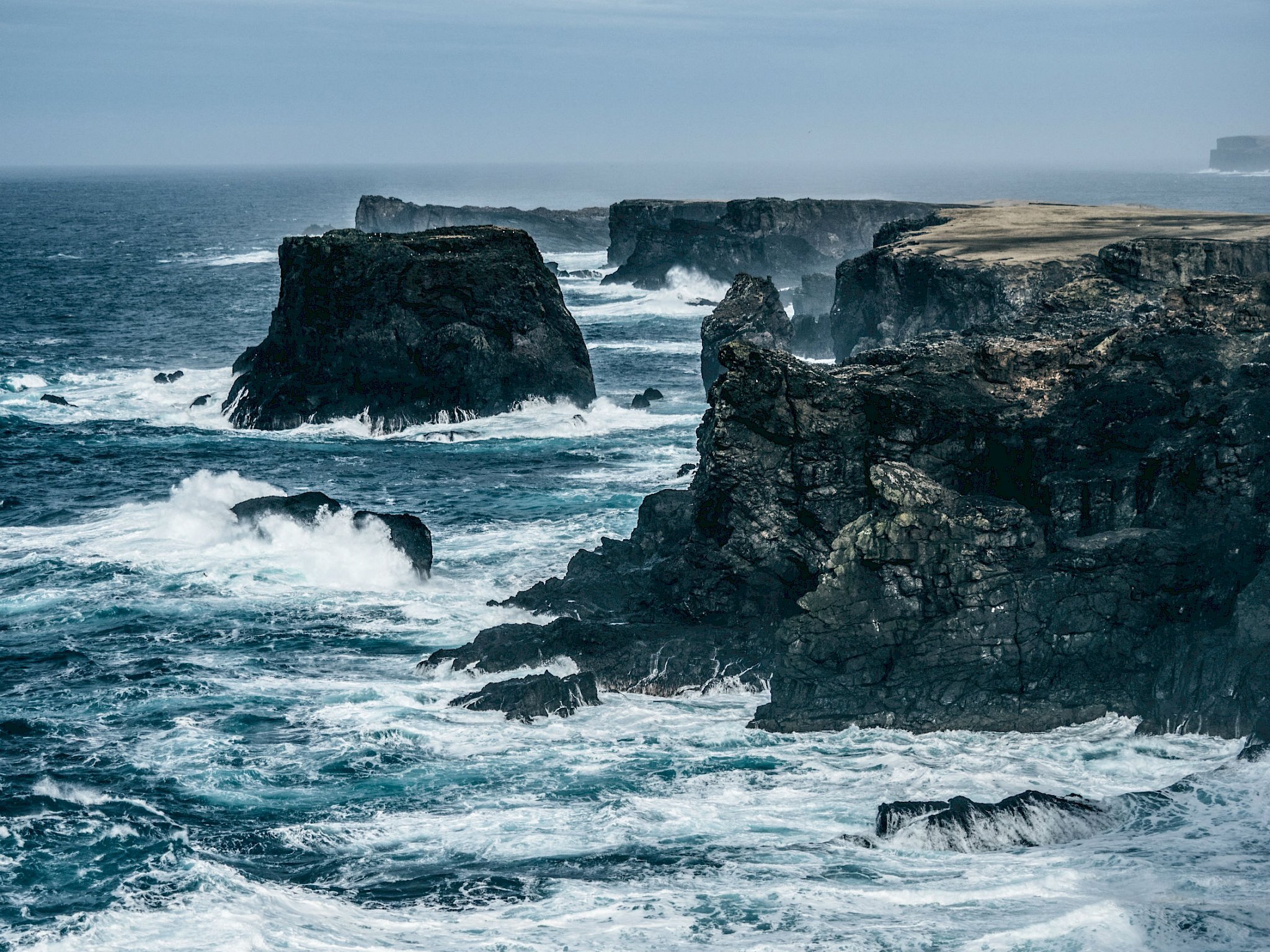
In Part One, I picked out the highlights in Lerwick, the south mainland and the nearby islands. This time, we head west and north, taking in the west and north mainland, plus the islands of Whalsay, Skerries, Papa Stour and Foula. In Part Three, we’ll visit the north isles – Yell, Fetlar and Unst.

As before, I’ve not suggested a rigid itinerary. Instead, I’m offering a sense of what’s to be seen in each district, with a rough idea of how long you might wish to spend there. Your focus will obviously depend on your interests and you may want to adjust your plans to make the most of the weather.

Shetland is larger than most people imagine

Heading west from Lerwick and crossing the Tingwall valley, travellers are greeted, at the top of Wormadale Hill, by a great view west and south. On a clear day, it can stretch 50 miles to Fair Isle and 20 miles to the island of Foula. Dropping rapidly to sea level, we’re in Whiteness, a pleasantly soft and green landscape, and then head north into Weisdale. There’s a jewellery workshop by the roadside and, a little farther north, on the shores of Weisdale Voe, there’s an excellent chance that you’ll see at least one heron (often, more) stalking in the shallows.

At the head of the voe, you can take the minor road northwards and you’ll very quickly arrive at the Bonhoga Gallery in the former Weisdale Mill. It has regular exhibitions of work by artists from Shetland or farther afield, and there’s an interesting gift shop. A conservatory café overlooking the stream offers snacks, teas and coffees. You can often spot another heron, or maybe even an otter, here.

Another half-mile or so north of the gallery, you’ll find something you may not have expected: a woodland landscape. Shetland doesn’t have many trees, but many of the ones that we do have are in this valley. Planting began in the 19th century and the plantations by the roadside and farther up the valley sides are well-established and carefully maintained. A surprising range of tree, shrub and flower species extends to such things as horse chestnut and copper beech, bluebells and foxgloves. There’s Britain’s northernmost rookery and an occasional cuckoo; and indeed this is a well-known birdwatching site, especially in spring and autumn, when migrants are around. Trees and shrubs do grow quite well in Shetland and were once widespread; their absence from open country has more to do with foraging sheep than the wind.

The house of Kergord isn’t open to the public, but it was one of the places used by the ‘Shetland Bus’ operation in the Second World War. Here, agents were trained and tried out sabotage techniques before making the risky voyage to Norway in order to support the resistance against the Nazis.

Returning south to the main road, the next stage of the journey west involves a long ascent to the Scord of Weisdale, where there’s another jaw-dropping view over Weisdale Voe and Whiteness. Down below, near the shore, a small group of trees marks the birthplace of a colourful character, John Clunies Ross, the so-called 19th century ‘king’ of the Cocos Islands.

Heading west, we drop down to Tresta, passing through another area of woodland before coming to the entrance to Lea Gardens, a botanic garden (and labour of love) that demonstrates just what a passionate and knowledgeable gardener can achieve at sixty degrees north.

By now, we’re in the west mainland, which is made up of the ancient Norse subdivisions of Aithsting and, farther west, Sandsting. It’s a large area, criss-crossed by a number of minor roads, and it’s best to take a good map.

Although there are particular things that you may want to see, the west mainland is mostly an excellent place to relax and unwind; it’s great for walking and fishing. If you’re having a holiday afloat, there are lots of places to drop anchor, plus local marinas. Seen from the air, there is an astonishing number of lochs, most of which offer excellent trout fishing.

...another jaw-dropping view...

The main road leads west to Walls (pronounced Waas) and we’ll look first at the area that lies to the south of it.

There are a couple of notable archaeological sites, including the mysterious Staneydale ‘temple’ and the Broch of Culswick. There are sandy beaches, for example at Reawick, and many shingle ones. There’s another botanic garden, Da Gairdins, at Sand.

Walls itself is a small but thriving village. There’s a bakery and other community facilities; and it’s also the port for the ferry to Foula, about 16 miles to the west.

Foula can be reached either by ferry from here, or by plane from Tingwall Airport near Lerwick. However, there is no shop on the island and limited accommodation, so any trip needs careful planning. Once on the island, though, the landscape is stunning and you can climb the hill to see the second-highest sea cliffs in Britain. Foula is a Site of Special Scientific Interest, noted among other species for its large population of Great Skuas (Bonxies).

How much time you devote to the West Mainland depends a lot on whether you want to make the most of the walking opportunities. If you simply want to tour the area and take in some of the highlights, you could cover most of the area in one day, but you need to allow more time if you want to walk some of the coastline or reach places such as the Broch of Culswick. It wouldn’t be difficult to fill two days or more, plus any time you might want to spend on Foula or Papa Stour.

Once on the island...the landscape is stunning

Nesting, Lunnasting, Whalsay and Out Skerries

If, instead of heading west from Tingwall, you continue on the main road north, you pass through Girlsta and, just beyond it, skirt the Loch of Girlsta, which is noted for being home to the rare Arctic Char. Taking the right turn towards Nesting offers an alternative route north; there are good coastal views and intimate coastal walks around Gletness. South Nesting, with green wildflower meadows and a fine trout loch, is very appealing.

Continuing into North Nesting, you’ll come to Laxo, and another right turn will take you to the fair-weather ferry terminal for the island of Whalsay; the ferry runs instead from Vidlin if it’s stormy from the south-easterly quarter. (You can also get here from Girlsta via the faster main road through the valley of the Lang Kames.)

Whalsay is associated above all with fishing; the islands’ families have a history of investing in modern fishing vessels and you may well pass one or two of these large purse-seiners on the right as the ferry enters the harbour at Symbister. Whalsay’s trading past, when merchants of the Hanseatic League had a base here, is recalled in the tiny booth by the harbour. Elsewhere on the island, there are archaeological remains, Britain’s northernmost 18-hole golf course and a large and impressively well-stocked charity shop in a former school, Shoard, which is great for browsing.

merchants of the Hanseatic League had a base here

North-east of Whalsay lie the Skerries, a low-lying group of three tiny islands, two of them linked by a bridge. This rocky, windswept landscape has limited potential for agriculture and fishing is very much the mainstay. You can get here by car ferry from Vidlin, though a car is superfluous, as there’s only about a mile of road.

Back on the mainland, continuing onwards from Laxo takes you northwards through Lunnasting. There is a shop and harbour at Vidlin; and beyond that, now on a peninsula, you’ll reach Lunna, once the original port for the Shetland Bus. Here, too, is a very beautiful little church that’s well worth looking inside. There are older structures around here, walls, buildings and paths, that recall a designed landscape associated with Lunna House.

There are lots of good walks in Nesting, Lunnasting, Whalsay and Skerries but how much you do obviously depends on how much time is at your disposal. However, you could spend a morning in Whalsay and visit Lunnasting and Nesting in the afternoon. A trip to Skerries needs some advance planning to take account of the ferry timetable but you’d be best to allow a full day.

a very beautiful little church

Delting, Muckle Roe and Northmavine

You can reach Delting either via the main road north from Tingwall, via Nesting or from Aith in the west mainland. These routes converge around the village of Voe, the older part of which, down by the shore, is very picturesque and strongly reminiscent of small Norwegian coastal communities. There are local services here, including a bakery and bar-restaurant, and there’s also a marina for those arriving afloat.

From Voe, there are two routes north. The eastern one leads past the strikingly fjord-like Dales Voe to Firth and then to the ferry terminal for Yell at Toft. The western one leads to Brae, which is the main service centre for the area, with a supermarket, swimming pool, restaurants and other facilities. Most of the buildings are less than 40 years old, for Brae was greatly expanded to house families connected with the Sullom Voe Oil Terminal about six miles to the north.

Taking the road north-west towards Hillswick, a rewarding side-trip is to Muckle Roe, a small island connected to the mainland by a bridge. The red granite landscape here, with cliffs and stacks, invites exploration on foot, or you can cycle on the track that leads into the uninhabited part of the island.

Back on the main road, a mile beyond Brae, you cross the isthmus at Mavis Grind, where it’s said you can throw a stone from the Atlantic into the North Sea – or at least Sullom Voe. From here northwards, you’re in Northmavine and you’ll notice that this is a much more rugged landscape, with many rock outcrops. It’s well worth exploring one or two of the side roads to the west, for example to the hamlet of Nibon. Continuing north-westwards, you reach Hillswick, which has a shop and a hotel; but just before the village, a right turn leads towards Eshaness, an area that offers quite wonderful cliff scenery, complete with collapsed caves, blowholes, natural arches, stacks and astonishing storm beaches. There’s superb, easy walking on smooth, clifftop grassland, with some lochs for good measure. There are other things to see, too, for example the Tangwick Haa Museum, which tells the district’s story, and the old fishing station at Stenness, one of many from which men rowed west, on perilous voyages in six-oared boats, to fishing grounds fifty or more miles away. In the midst of all this, there’s a café with fabulous views, tempting cakes and a well-equipped campsite.

...wonderful cliff scenery...

That’s not all that Northmavine has to offer. By taking the branch road signposted for Ollaberry and North Roe, you weave northwards through impressive scenery; a minor road to the left leads up Collafirth Hill and from the top there are excellent views. From here, too, you can set out over the moor (which has sub-arctic soil patterning) to the summit of Ronas Hill, Shetland’s highest peak. It’s best to allow around three hours for the return trip and of course you must be properly equipped and take all the usual hillwalking precautions, because the weather can change quickly. There’s an account of the walk here. To the north and west of the summit, it’s a landscape of moorland, lochs and spectacular cliffs and beaches.

In the far north of Northmavine is the hamlet of North Roe, and beyond that, a track offers the possibility of a great walk to another former fishing station in a beautiful setting at Fethaland.

You could tour Delting and Northmavine by car in one day, but that doesn’t allow much time for exploring on foot; possibly just a walk along the cliffs at Eshaness and either Ronas Hill or Muckle Roe. Northmavine alone can easily fill two days and another day to take in Muckle Roe would be wise.

In Part Three, we travel farther north, to Yell, Fetlar and Unst.