
A new website and apps offer comprehensive travel information for users of buses, ferries and internal flights in Shetland.
Shetland is larger than weather maps might suggest, stretching more than 90 miles from north to south and around 50 miles from east to west. With 17 inhabited islands, the need for good transport links has always been recognised and there are excellent road links, reliable ferries and a bus network that, for a rural area, offers surprisingly frequent services. Internal air services are also available, particularly to the outlying islands of Fair Isle and Foula.
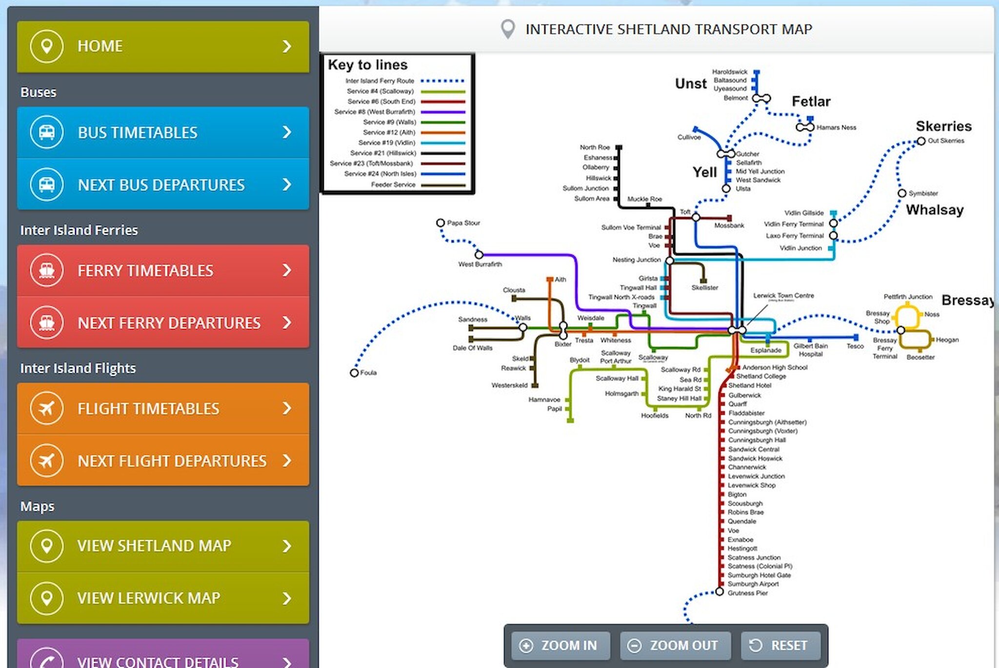
Recognising that full information about services is as vital as the services themselves, Zet-Trans (which co-ordinates local transport) and Promote Shetland have launched the new website, built entirely in Shetland, that brings together all local transport information. An interactive map shows all the bus and ferry routes and it's possible to search for bus, ferry or internal flight services from any point on the network.
The new site, complemented by apps for mobile devices, should make it much easier to check travel arrangements and it's hoped that those visitors to the islands who tour without a car will also find the service useful.