Directions to start
Unfortunately, Fethaland is not accessible by public transport, so we'd recommend travelling by car to the start point of this walk.
Unfortunately, Fethaland is not accessible by public transport, so we'd recommend travelling by car to the start point of this walk.
Isbister is the starting point for this walk. Most of the going is straightforward, but care must be taken at the northern section, where cliff edges can be very dangerous, especially in wet or windy weather. Vehicles should be left where they will not block access to entrances, or inconvenience local farmers and residents.
Take the track that leads to east from Isbister, stopping at the old Kirkyard to examine some rare wooden grave-markers which can still be seen, standing here among the stone ones. Continue past the Loch of Housaquoy where interesting duck and sometimes divers can be seen here at certain times of year and follow the coast north.
Away to the right, an ancient monastic site existed on the Kame of Isbister, an inaccessible spur of rock, jutting out seawards from the cliffs here. It featured in the TV series "Extreme Archaeology" some years ago, as did a similar site directly opposite, on the west coast of Yell. Between May and August, the wild flowers along this walk can be wonderfully varied and colourful.
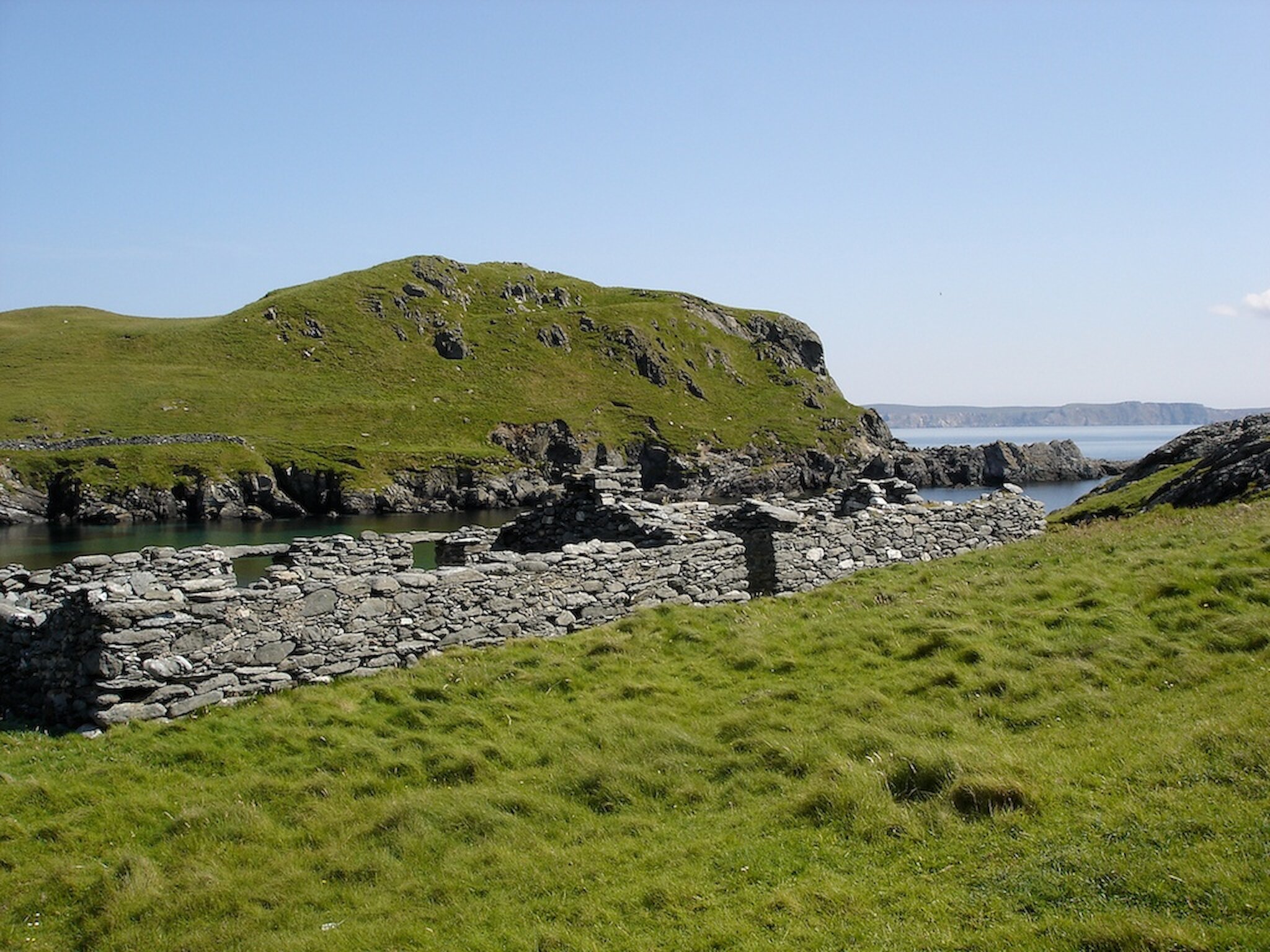
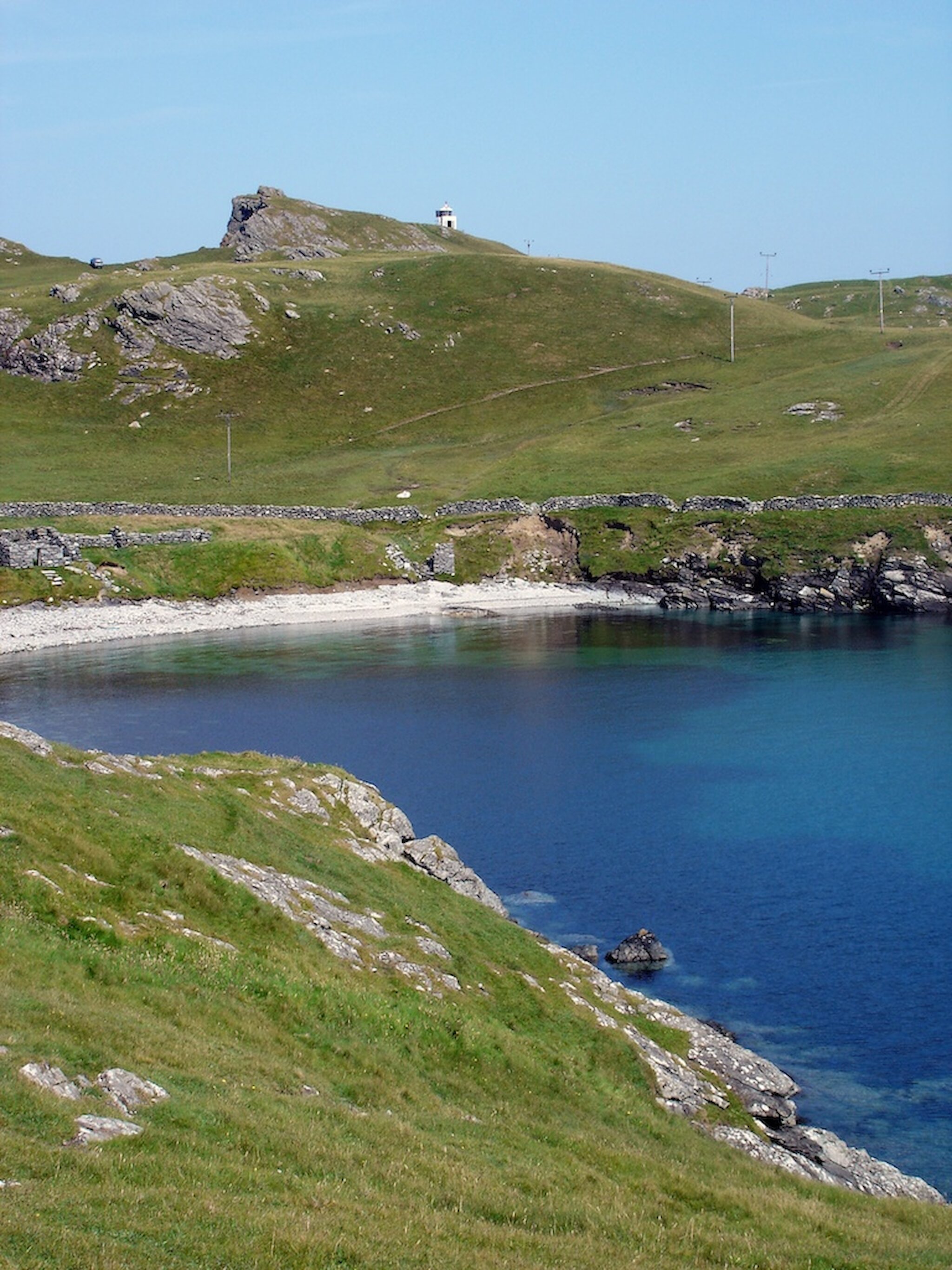
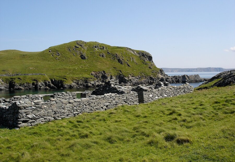
The route continues up north across hill and moor, fine views of Ronas Hill to the south until you reach the remains of the old fishing lodges at Fethaland itself. This was the largest of Shetland's fishing stations. with up to sixty boats operating between here and the "Far Haaf", which was the local name for the edge of the continental shelf, about 50 miles to the west. The boats were sixereens, open, six-oared wooden vessels, built along traditional Norse lines.
Immediately to the west of the lodges an Iron Age broch once stood, its mound providing the shelter here. There are other archaeological sites nearby, including the circular wall outlines of a large Neolithic house. In the sea washed shingle strata, you can still find occasional fish bones, relics of the industry which, long ago must have transformed the area into a noisy, smelly hive of activity at the time.
You can continue into the final section of the headland to the lighthouse and look out for seals, gannets, and other seabirds. Cleber Geos contains an old soapstone, or steatite, quarry and is now a protected archaeological site. Notice the old names, carved in the worked rock face and the shapes of large stone bowls, which were carved from the soft soapstone. Troughs and bowls made from this rock have been found on many archaeological sites in Shetland.
Returning to the fishing station, you can now make your way along the track up over the Rigg of Breibister and past the Upper Loch of Setter. Charles Ratter, the last Haaf skipper from Fethaland once crofted this very fertile area. From here continue along the track back to Isbister.